
Dolmen de la Siureda
with Tim and Chris Parker
A circular 10.5km walk with approx. 440 metres of ascent. Allow 3 hours.
Suitable for all with a reasonable level of fitness. Yellow waymarking which is a little patchy in a couple of key places!
Walking boots recommended.
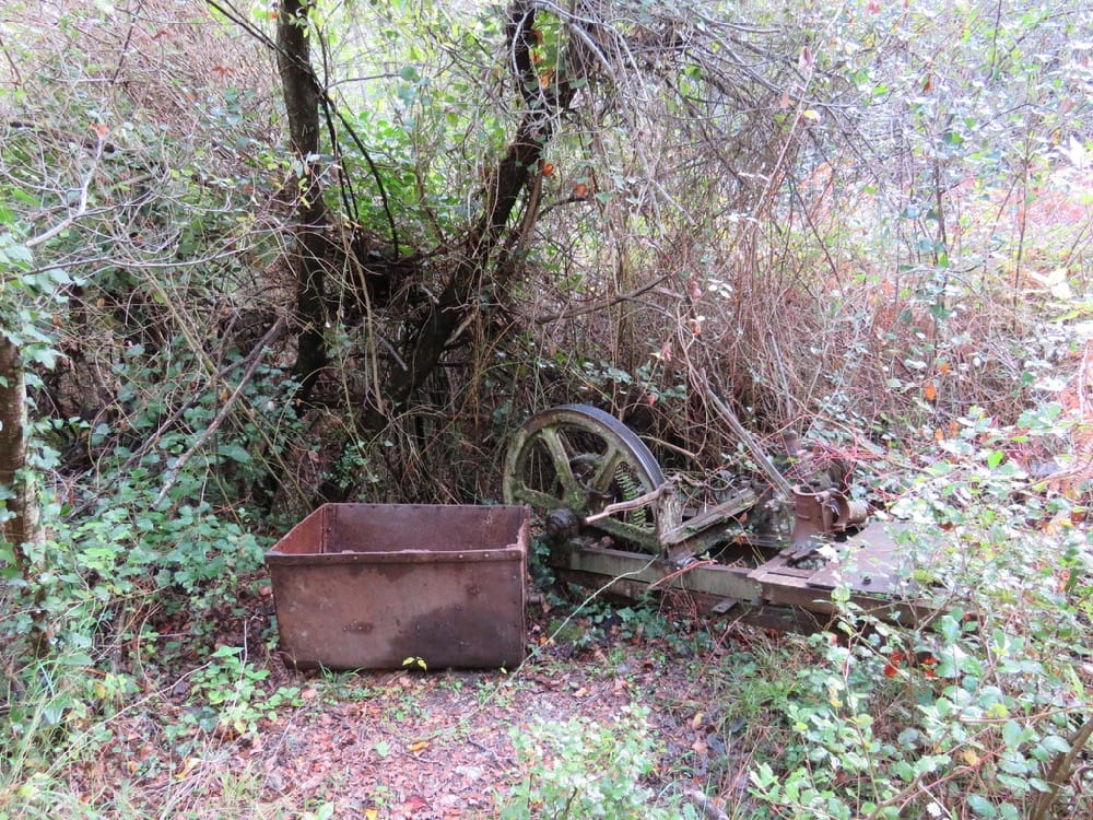
Walk includes visit to Neolithic burial chamber, remnants of old mines and views from la tour de Bel Oeil.
Access: map IGN 1:25000 Ceret Amelie les Bains Palada 2449 OT
Start:
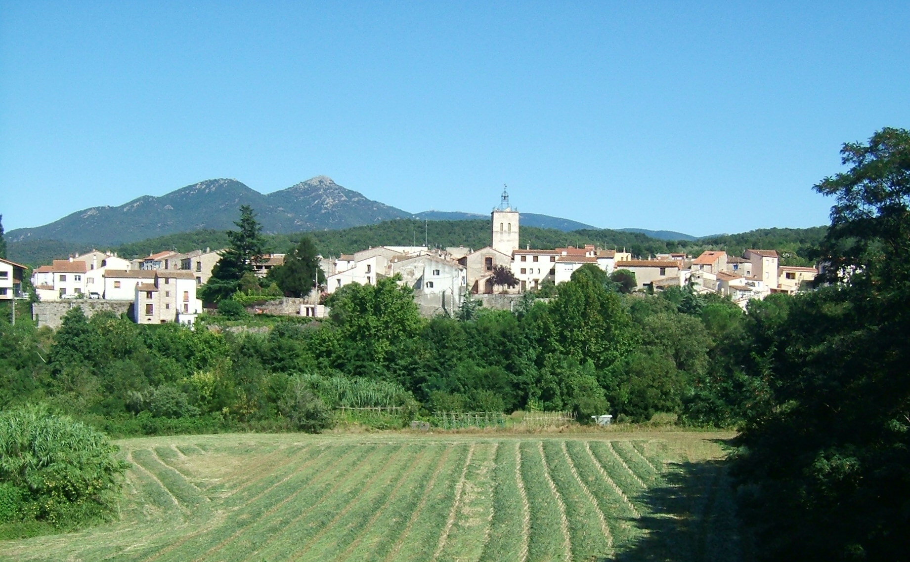
Take D900 in the direction of Le Perthus. Follow directions to Maureillas las Illas, taking D618 under A9 motorway. Cross the town and continue in direction of Céret to emerge at roundabout by the entrance to the park, just before a bridge. Cross roundabout to park in car parking area for Prat de la Fargue. (Toilet available)
The walk:
Cross the bridge and immediately go down steps on left, following waymarks to cross land beside Equestrian centre – keep this on your right. Enter woodland, keeping to path on left and climb gradually to emerge in a residential area.
Follow road straight on for 50 metres then bend left across grass area behind recycle bins to follow path behind houses (properties directly on your right). Emerge on section of tarmac road, soon branch left to reach large, gated white property. Take path on left to enter woodland again.
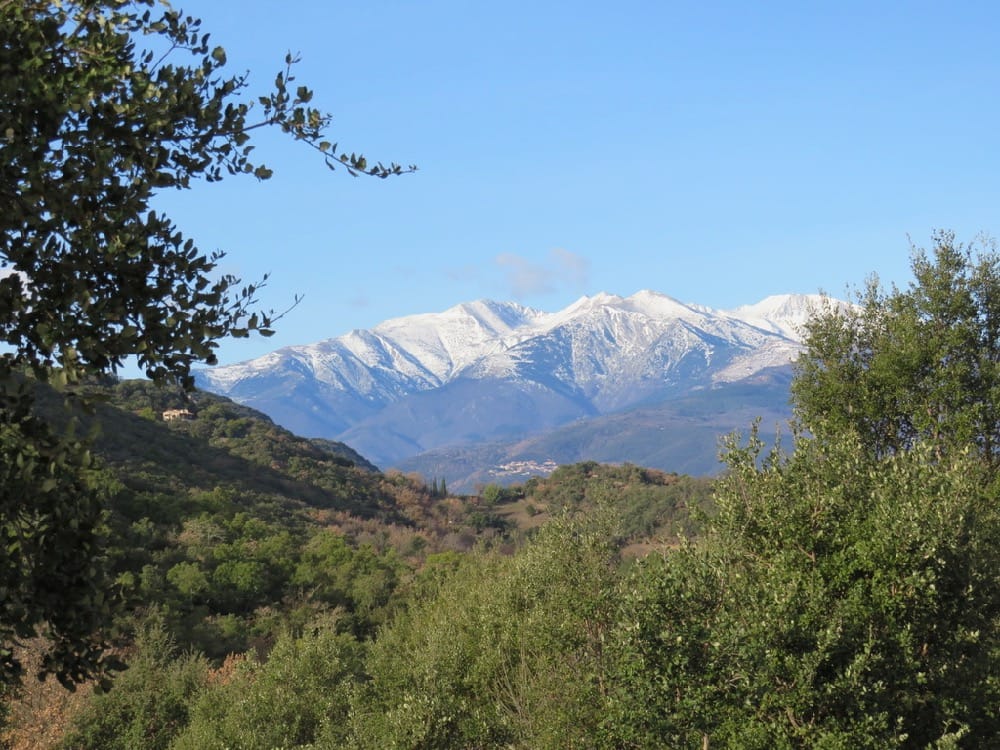
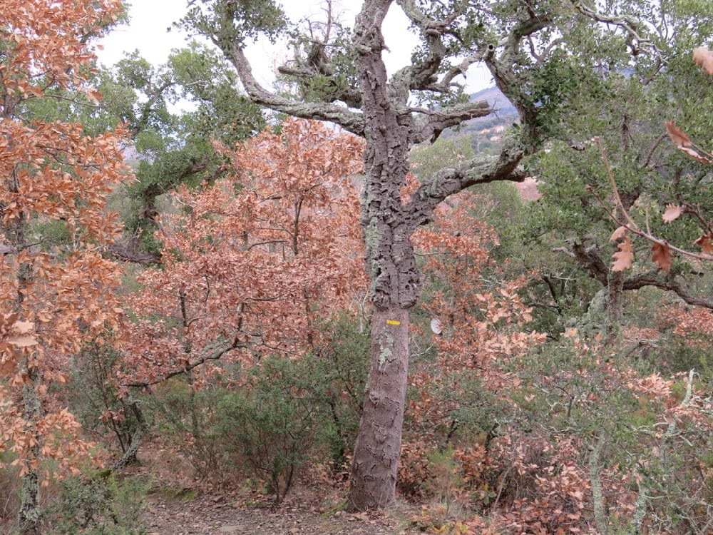
Path climbs gradually through cork oak woodland and eventually follows mesh fencing, to emerge, 30 mins from start, on an open, recently planted area with great views of le Canigou.
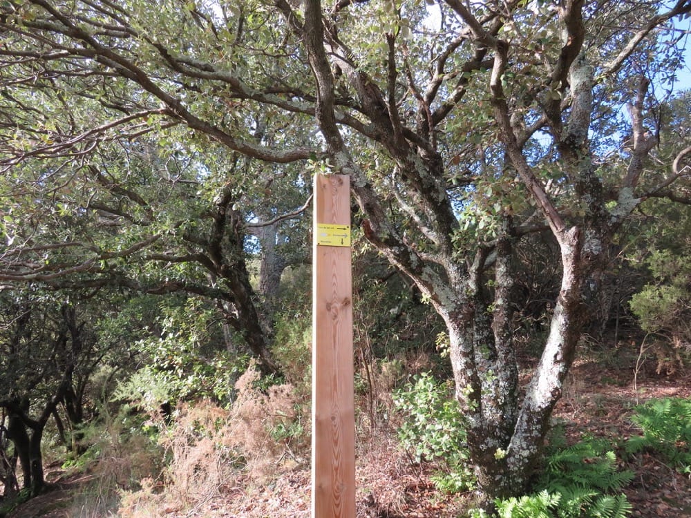
Bend left with the fencing then immediately right to continue upwards. Quickly arrive at panel indicating direction of the dolmen and the old watchtower. Follow yellow waymarks and ignore path to left – this is return route.
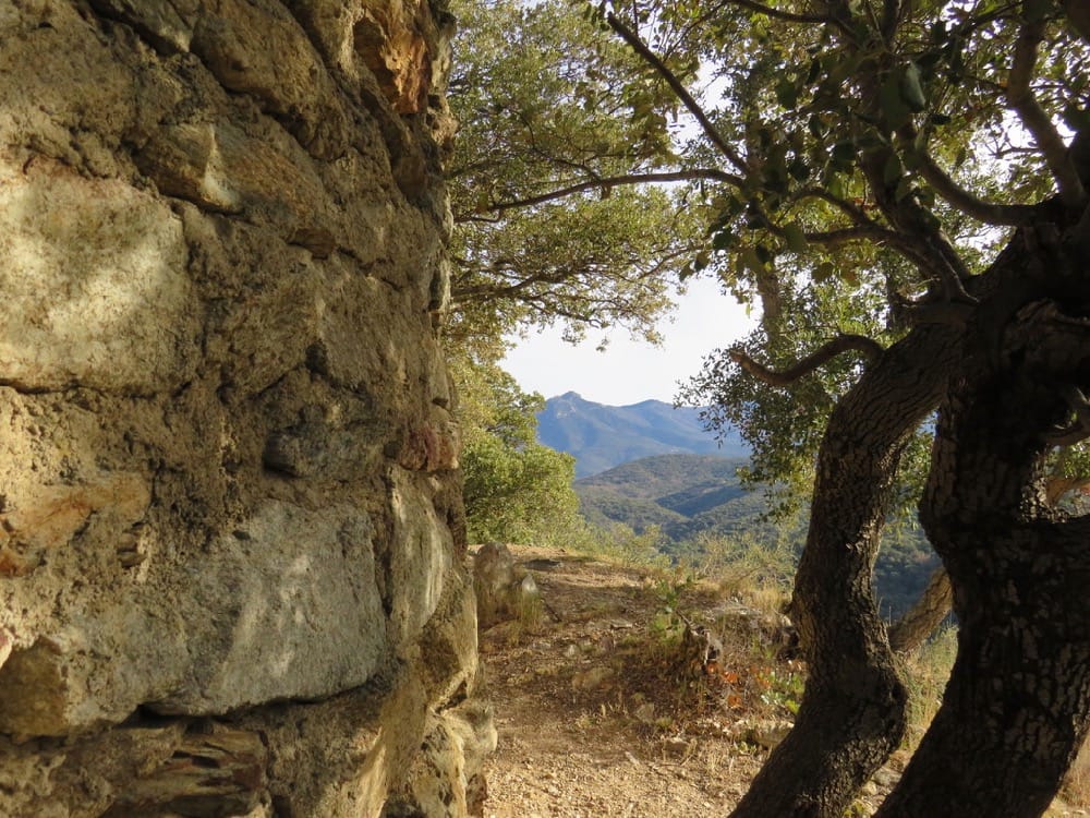
Continue to climb and soon find path going left to la Tour de Bel Oeil. A diversion to visit the site is worth it for the views. (8 mins aller-retour)
Return to main path and continue upwards and contour round the forested hills, emerging near the properties of les Hauts de Ceret and a water cistern.
Turn left to follow the broad track. Reach tarmac road, turn left and follow this uphill for about a kilometre to reach the dolmen de la Siureda on left just after a sharp right-hand bend. (1.5 hours to this point)
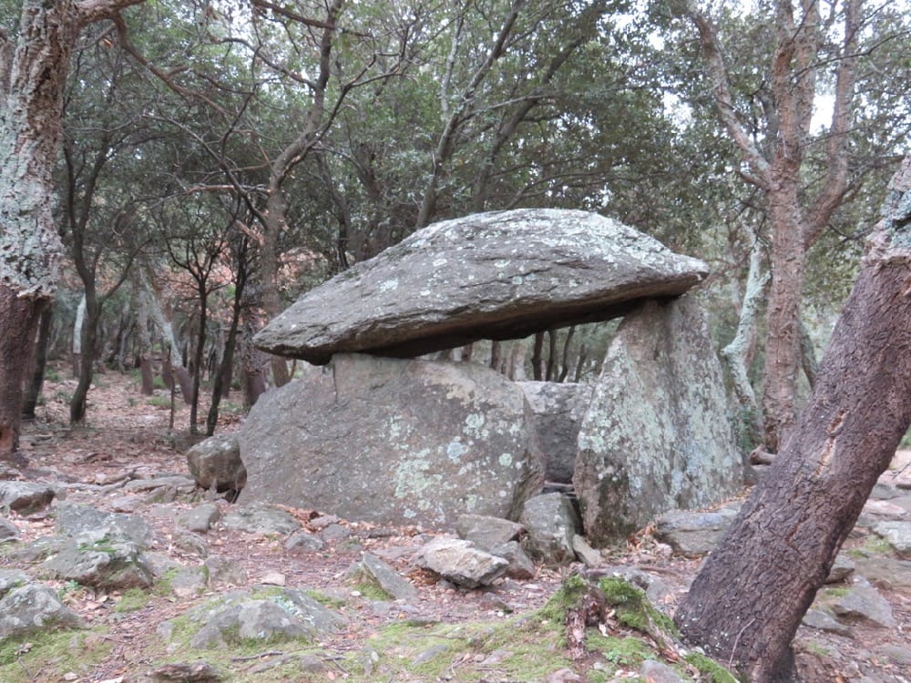
The dolmen is a Neolithic burial chamber. Point to ponder – how did they build with stones that size in those days?!
The dolmen was discovered in 1985, buried under a lot of earth and vegetation and with a tree growing out of it. Archaelogical studies of the site revealed some bones, a bronze bracelet and other artifacts dating from 2000 BC. Evidence also suggests it was used again in the late Bronze age (1000-700 BC)
From dolmen take broad path to left (ignore yellow cross on a tree)t and follow it downhill. After 10mins, ignore broad track on right (yellow cross) and bend left to cross a wire fence, currently marked with a white cloth, cross a stream bed and contour straight on round the hill. (Do not take the track descending alongside stream on right – waymarks are lacking at this point)
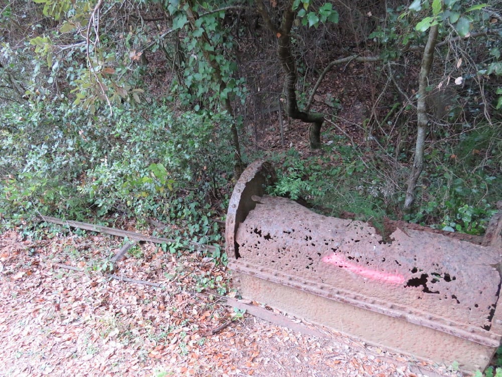
Arrive quickly at an intersection, turn right and continue to follow path, mainly descending, to emerge after a further 50 mins, at the panel encountered on the ascent. On the way, near another stream bed, notice the remains of talc mining in this area. Also take care soon after these – the path goes slightly up to left. (3 red dots on tree but no yellow waymark!)
At the panel, turn right to retrace your steps down to Maureillas – 30 mins.