WALK THE REGION WITH MIKE RHODES
Les Lacs de Camporells from Formiguères
A great introduction to the higher mountains. Generally done in the summer months of July & August when the chair lift, starting at 9.00am, whisks you up the first 350m climb, but it is also possible, after the winter snow has melted, to drive up the forestry track to the same place.

- From the top of the lift, follow the wide forestry track on the left, climbing gently to the west, for 700m, past an information board and barrier until you see a path way-marked in yellow leading into the trees on your left.
- Follow the path just to the right of the ridge crest until after 1km you will see the top lift building of the Formigueres ski station on your right.
- A steeper climb takes you up into a shallow, rather bleak valley, where all of the stunted trees and bushes have been twisted into tortured shapes by the wind.
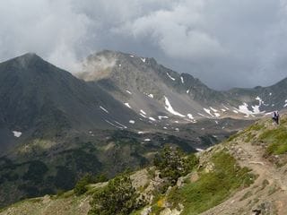
- The rocky path now climbs gently up to a small col where suddenly the imposing mass of the Pics Peric come into view. Pic Peric makes a superb walk for the fit hiker but takes an extra 4 hours, 700 of climbing, as well as taking you into more serious mountain terrain.
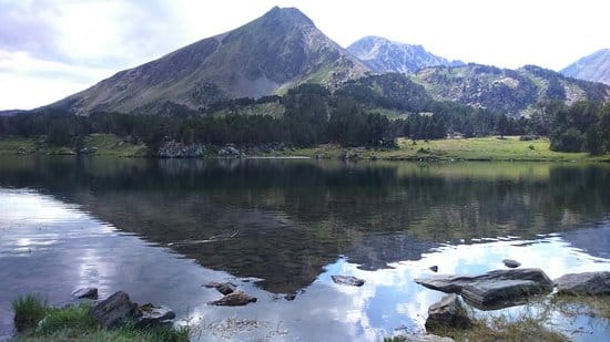
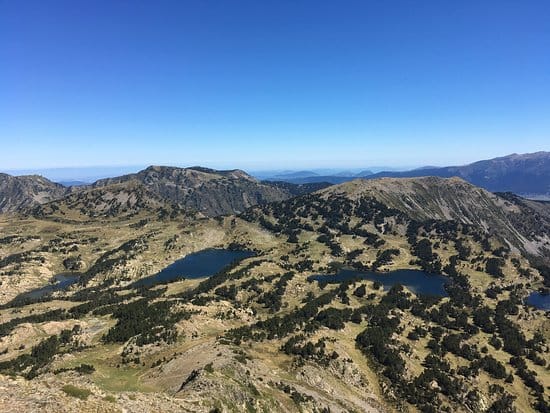
- Just after the small col the path splits and we take the RH one heading towards a small peak, Sierra de Mauri 2428m where we can have a break to admire the stunning views. Below us to the west, are the dozens of lakes making up the site de Camporells, specially stocked with mountain trout for the keen fishermen.
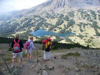
Beyond the lakes you have the Pics Peric 2810m with the Puig de la Portella Gran 2769m just to the right. To the north, the first peak is La Muntanyeta 2436m, suitable for including in todays walk and beyond in the distance you will see the shapely peaks of Pic de la Tribuna 2498m & Pic de Baxouillard 2546m overlooking the Gaube valley.
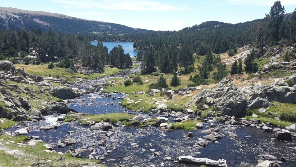
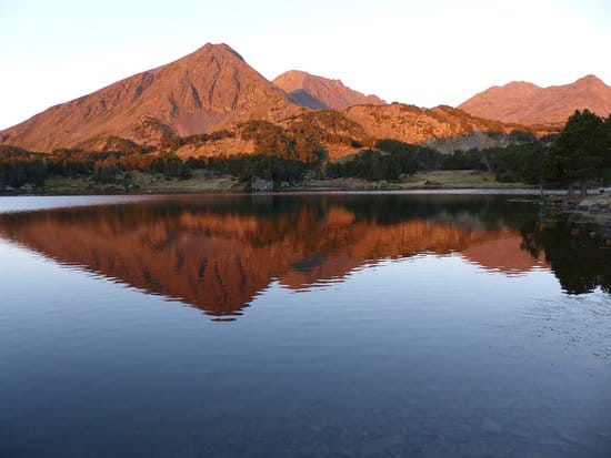
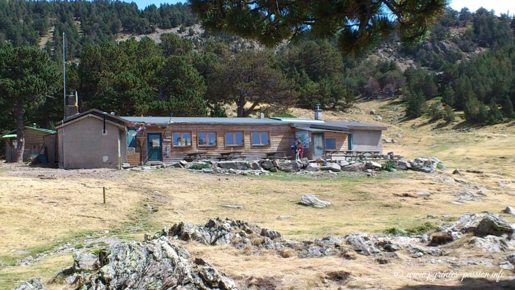
Our next objective is the refuge de Camporells situated on the banks of l’Estagny del Mig.
- From the sierra de Mauri we descend slightly to the right and pick up a wide path which bends to the left and descends in wide zig zags until you suddenly turn a corner and the newly extended refuge comes into view.
- From the ski station car park we will have taken between 2 – 3 hours to this point, including time on the lift and view breaks so lunch may now be calling. Search out a secluded spot by one of the lakes and absorb the beauty of this special place.
Why not make this a two day trip and stay the night at the refuge? Blankets are provided but you will need a sheet sleeping bag. You can also get a meal there but at the time of writing they are making changes so check out details HERE

The benefit of this walk is that those wanting to take in a peak can take on the challenge of the Perics or La Muntanyeta whilst others can have a leisurely lunch.
Why not bring a light set of fishing tackle and try your luck in the lakes, but don’t forget to buy a permit at Loosport in Formiguères village?
- The most popular way back is to follow the same route to the top of the ski station and then follow the ski piste to the left all of the way back to your car, if you parked at the station. If you drove to the top of the first ski lift then follow the same route as you ascended.
- An alternative descent is to follow the Lladure valley to the south. To take this descent, go south from the refuge for approx 400m to where the paths split.
- Take the LH one heading east descending steeply into the Lladure valley on a good track. Once in the valley floor at about 1870m you descend gently for 2kms until you see a forestry track climbing up to your left. This track climbs for about 2kms and then descends gently back into the ski station.
This alternative descent will take at least an hour longer that the normal descent. If you are planning to go down on the ski lift, check the last descent time and be aware that the lift will not run if there is any risk of a storm in the afternoon.
The total distance is approx 8kms with 500m of climbing, without any detours. Total time, using the ski lifts for ascent and descent will be 4 – 5 hours giving plenty of time for stops and lunch. Although this is technically an easy walk, you are in a high mountain situation where any accident will have serious consequences so make sure that you are well equipped including a map, compass, first aid kit and some sort of group shelter. Check the meteo before you leave and have the phone numbers of the mountain rescue service.
STOP OFF IN MONT LOUIS ON YOUR WAY UP OR DOWN AND LUNCH OR DINE AT LE DAGOBERT.

Mountain rescue: PGHM (Peloton de Gendarmerie de Haute Montagne Osséja 04 68 04 51 03 (or ring 112 to be transferred)
Mike Rhodes is an International Mountain Leader / Accompagnateur de Montagne, lives all year in Les Angles and specialises in guided walks in the high mountains and Snowshoe trips in winter. He can be contacted on 0033(0)468043728 – mike.rhodes@free.fr or visit his website