Walk the region With Leigh and Merry Foster
This walk is steep in places, and took us about 51/2 hours in total (with lots of stops to admire the scenery!). The use of stout walking boots and a stick is definitely recommended, especially for some of the rockier climbs. The views are fabulous, overlooking Le Perthus, the Roussillon plain, and over to Canigou and Neoulous
Access : Map IGN 1:25000 Banyuls/Col de Perthus/Cote Vermeille (GPS) 2549OT.
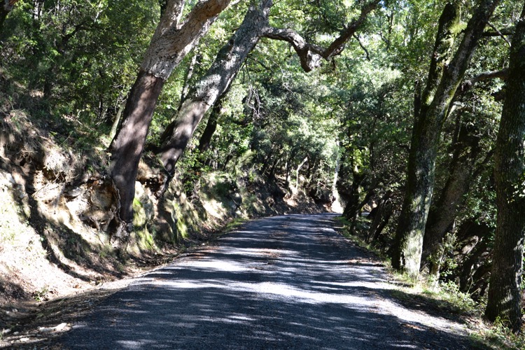
The start point is St Jean de L’Albere on the D71 road from Le Perthus to Neoulous. Park here in the pretty shaded village & start walking west along the road until you come to the yellow sign pointing up the hill labelled “Coll de Llinas” with a very optimistic time estimate of 1h20.
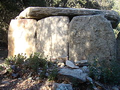
The altitude here is about 540m and the Col is at 800m so it’s quite a steep climb, but you get lovely views over Le Perthus and to Canigou. On the way you pass the mysterious Dolmen Na Cristiana, reputed to be the best example in the P.O, at 650m altitude, 490600E 4703650N with its massive Neolithic stones positioned incredibly precisely
Walk : Yellow marks throughout
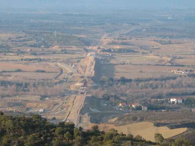
Walk from here, following the yellow (and sometimes blue) marks, traversing north and west below the Coll de la Branca. If you follow some orange marks leading to a big P7 painted on a rock, you’ve gone the wrong way; this seems to be a mountaineer’s route straight up the hill! Continue up north to the Coll de Llinas 490300E 4704730N. From here you can enjoy the views over the Roussillon plain, Le Boulou and the TGV track can be seen clearly at Montesquieu to the north.
After catching your breath, continue along the well-defined track to the east, as it starts to zig-zag up to the Puig. On the north side of the peak there is another track which branches off above a concrete wall at 490920E 4704650N.
Turn south-west to reach the peak, continue following the path until you reach the small stone refuge built on the top. This could provide basic shelter in a storm but few home comforts! The views from here (1000m altitude) are amazing with 360 degree vistas from Spain to the south, Canigou in the west and Neolous and the coast in the east. Time for a picnic.

Going down you can either retrace your steps, or continue east along the ridge. There are two ways down, from Coll de la Font or Coll de Sant Joan 492150E 4704130N. The former looks steeper, so we took the latter which was still quite precipitous. It descends a long way through a thick forest of cork oaks, finally meandering through meadows back to the road into St Jean.
The total distance is about 9km, with 660 metres of ascent and descent so it requires a reasonable level of fitness, but it’s well worth it for the views, and the appetite it gives you for your well-earned dinner!
If you start the walk early enough, you may get back in time for lunch a little further down the road from the village, at Can Joan. Beware if you’re thinking of lunch first though. This ancient farmhouse offers long lazy lunches in front of a roaring fire!
A list of walks suitable for wheelchair and mobility scooter access – ie smooth surfaces – would be very useful.