A circular 3h 15 mins walk with approx. 380 metres of ascent. Starts with descent to Montner and then ascent to Força Réal, with final descent to Col del Bou via Le Sentier Botanique.
Yellow waymarking.
Access: map IGN 1:25000 Thuir Ile sur Têt 2488 OT
WALK THE REGION
with Tim and Chris Parker
Start: From Perpignan follow the River Têt on the N116 direction Ille sur Têt. Take the exit for Millas. Go through the town, turning right to cross the river Têt. Continue following signs for Força Réal, turning left at the roundabout once across river, and climbing on D612 to the Col de la Bataille. Turn right onto D38 towards Força Réal and park at the Col del Bou, about 1km from the Col de la Bataille.

After the treaty of Bayonne, which set the borders between France and Spain, the King of Aragon, Jean II, handed over the Roussillon and the Cerdagne to Louis XI of France. Years later, Louis’s successor, Charles VIII, decided that the rebellious Roussillonnais were a nuisance – he no longer wanted them, and handed them back to Spain!
In 1496 this fickle king changed his mind again, marched back into the Roussillon and waged war to win back the region, a decisive battle which took place on the Col de la Bataille, as it was subsequently named.

It is on this ancient battle ground that you will find a poignant memorial to members of the resistance group Henri Barbusse, whose leader Julien Panchot, along with other members of the group, was interrogated, tortured and shot by the Germans whilst defending the villagers of Valmanya.
Archive records state “il lui ont brisé les tibias avec une barre a mine attachèe sur une table pour le faire parlè”.

Symbol of Catalan resistance. The village of Valmanya (Great valley in Latin) near Vinça, was totally destroyed by the Germans in August 1944, in reprisal against resistance fighters operating in the area.
Villagers who were unable to flee to the safety of the mountains were machine gunned. From this ‘maquis’ stronghold, Captain Julien Panchot led brave resistance fighters who sheltered in the nearby mines of La Pinosa and set up the Sainte Jeanne escape route for refugees. The village was rebuilt but the ruins of the mines remain.
The walk: Descend behind parking area and go left on broad track signed as Montner Força Réal circular. After 100 metres pick up footpath on left to proceed at same level for a time before path drops down to a cabin (15 mins to this point).

-
- Turn right on grassy track to reach a tarmac road.
- Turn right to follow road round left-hand bend and pick up road on left. (Turns are marked with yellow lines, while yellow crosses mark tracks not to be followed). The tarmac road soon becomes a rough track which turns right near a breeze block cabin and eventually leads to the village of Montner (1 hour to this point).
-
- Cross the village to take Rue de Força Réal on right. At end of street keep left into new housing and exit the village. Just before a small water pumping station, take right turn (waymarked) onto broad track into the vines.
- Emerge onto tarmac road and just after sharp right-hand bend in valley, take left turn into vines, then immediately right alongside a hedge – turning marked with a cairn. Go uphill through vines to emerge on tarmac track. Turn left.
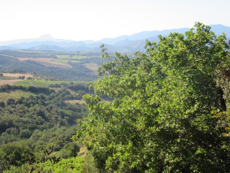
- Track soon becomes rocky and goes uphill, quite steeply in sections, to emerge on flat circular area next to D38 near summit of Força Réal. The short climb to the top is rewarded by wonderful 360o views to the coast and inland, across to the Corbières and beyond. The two features on the top contrast tremendously – the red and white telecommunications mast of modern times and the ancient Ermitage de Força Réal.
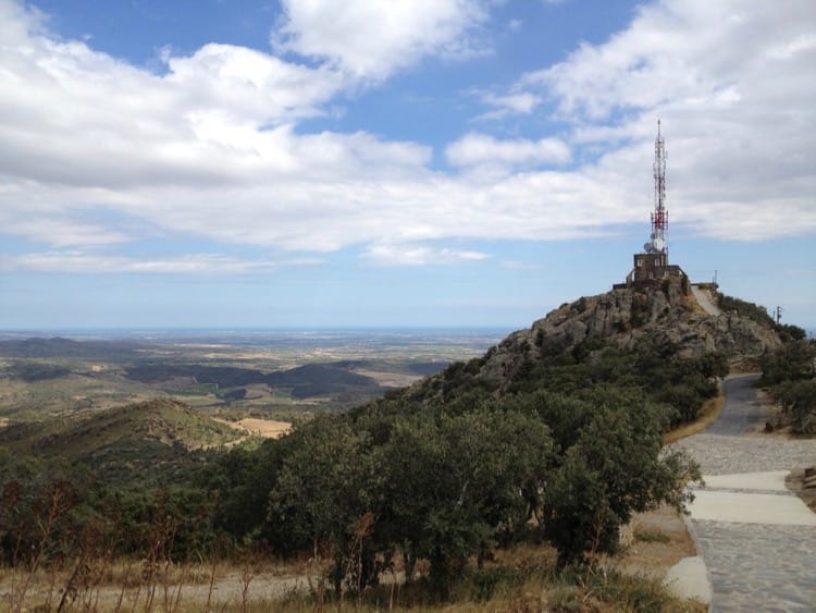
- Nothing remains of the original 13th century fort on the summit, the Força Réal or Royal Fortress, which gave its name to the hill, but the polished steel convex mirror by the path approaching the chapel offers interesting photographic opportunities. Facing it, take a picture of yourself and everything or everyone behind you!
Over the years, Força Réal (Royal Fortress) has been many things to many people! Signal tower and fortress for the defence of the Roussillon, welcoming beacon landmark for returning fishermen, hermitage, and today a ‘tour de guet’ for fire spotting. On a clear day, the view will take your breath away.
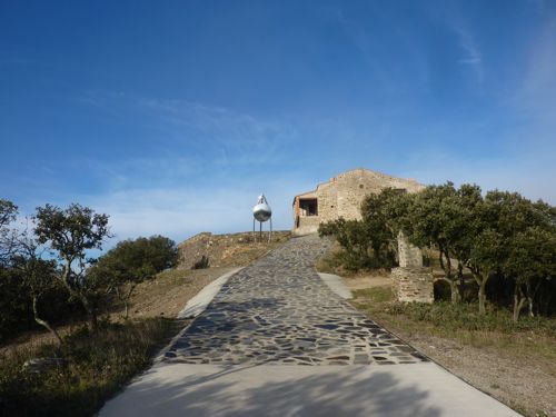
Built in 1258 by the kings of Aragon to reinforce Roussillon defences, the original signal tower and small fort, constructed on two adjacent hills, were destroyed in the 17th century. The fort was transformed into an hermitage and ‘Conjurador’, its function to appease the elements and chase away storms and summer drought.
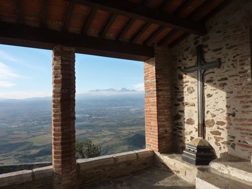
Unfortunately, the chapel is rarely open, but masses and processions do take place there on festival and Saints’ days.
A visit to Força Réal is not recommended on a windy day, unless you wish to lose your hat and anything else that’s not well secured to your body!
- To descend to Col del Bou pick up the Sentier Botanique from the flat circular area on which you emerged near summit, or walk down the road a little to find access to it on right. There are 2 routes back to the Col – one to left of the hill and the other over its right-hand edge then round the back of it. Those interested in plants will find plaques with the names of trees and plants on the route down.
- A few steep shortcuts are available near the Col to cut across the hairpins of the broad track.