Cycle the Region: Le Boucle des Albères
With Leigh and Merry Foster
Key Info Length 20km Duration 1-1.5 hrs. Difficulty: easy with a few moderate climbs Total climb/descent 260m This is one of our favourite circuits that we have done fairly regularly in the last few years. Recently there have been extensions and improvements to the EV8 cycle path which passes by Sorède, so we decided to try them out. |
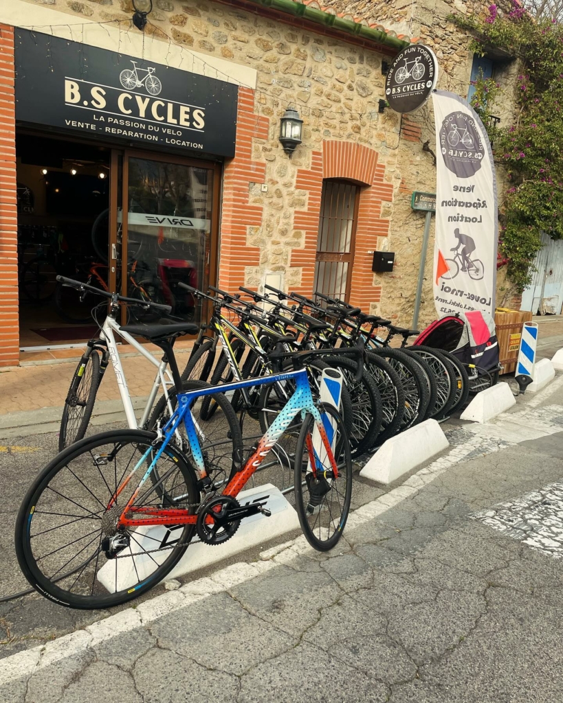
Our circuit started at the recently-opened bicycle shop in Sorède. You can buy or rent a bike here, the service is good and the bikes are very good quality. Merry’s cousin joined us and wanted to rent an e-bike, which turned out to be very easy to ride (even uphill!) and comfortable.
You start off on the D2 Route de Laroque, heading west out of Sorède and down the hill, which is a great way to start.
After climbing the hill into Laroque and traversing the town, you follow the signs to Saint Génis.
Just after the bridge that crosses the main river, turn left towards Villelongue dels Monts on the D11, Avenue du Vallespir, opposite the primary school. This road takes you out of Laroque into the pretty countryside and past a couple of camp sites.
After about 2km the road does a zigzag across a bridge and you start to climb into Villelongue. This is where the e-bikes earn their keep!
In the centre of Villelongue you have to turn right, then left, to stay on the D11, signposted to Montesquieu. Pass the church and continue following the signs.
On the way out of the village you cross the bridge, and head down past the Boulodrome. After about 500 metres you cross a river (alt 89m), then the road turns south and starts to climb towards Montesquieu.
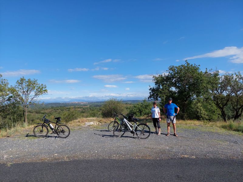
About 600 metres on, the road curves right, and there is a stopping place on the right where you can get a great view of the plain of Roussillon and have a breather!
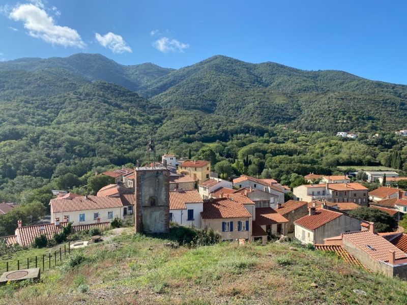
After a short break you continue to climb as the road winds up through the cork oaks and vineyards towards Montesquieu. About 1.2km from your stop, you pass a spring labelled “Font del Carex” on the left, before continuing to climb into the centre of Montesquieu (alt. 179m) where the D11 terminates at the T junction with the Grand Rue.
While here it’s worth having a look at the site of the 11th c. medieval castle – although very little of the original castle remains, the views from the top of the plain and the Alberes are superb.
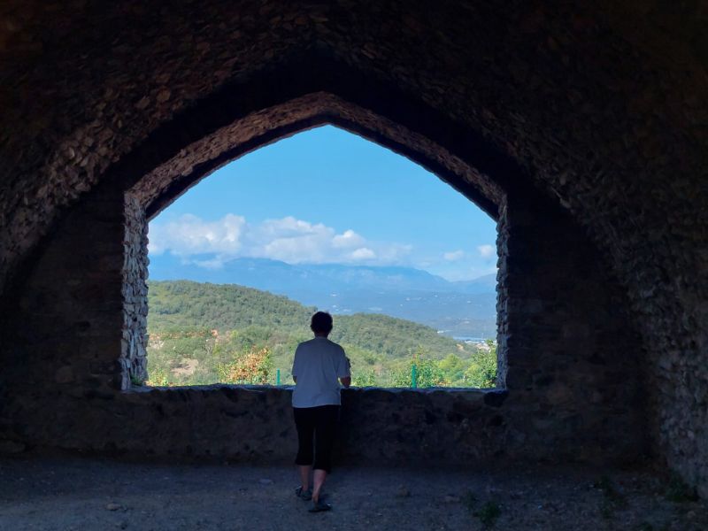
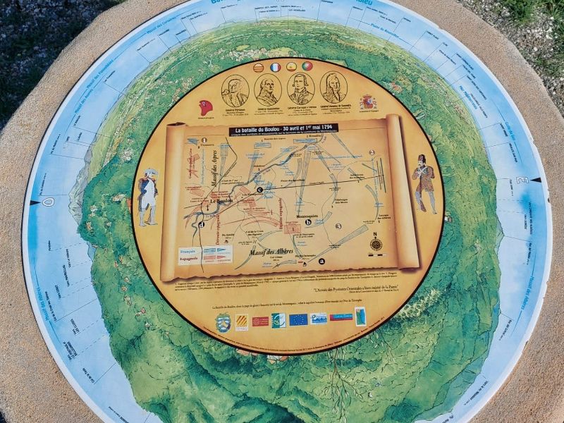
There is a small table d’orientation which describes the battle of Le Boulou, in which the castle played a decisive part.
After visiting the castle, you need to find your way back to the Grand Rue, and follow it east to the Chemin du Roi which descends on the east side of the castle. The anti-clockwise one way system means you can’t follow the D61 around the west side.
After a short distance you come to another T junction where you ignore the ‘Toutes Directions’ sign and turn right. This is the Chemin de las Serres, it’s a quiet road, a bit gravelly in places, but it is a welcome descent through some lovely countryside and vineyards.
At the bottom of the hill (alt 62m) you reach another T junction and turn right on the Rue de la Plansounade towards Villelongue. It seems that this road could also be reached from Le Boulou if you’re starting from there.
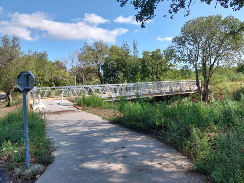
Follow this road/track, which has been resurfaced in places and painted with cycle path markings, for about 1.3km until you come to a brand-new metal bridge where you turn left across the Rivera de Vilallonga. This is the latest part of the EV8 cycle path, and it winds its way east through vineyards and woodland until you reach the Traverse de Villelongue (alt 80m) about 3km from the T junction above.
No doubt the cycle path is intended to continue from here in future, but for now you have to turn left and follow the road down into Saint Génis des Fontaines.
At the edge of the village there is a fork in the road. The right fork has a no entry sign, but it doesn’t apply to bicycles! The official cycle path continues this way into the village, so just look out for any distracted drivers coming the other way!
Continue following the signs for the cycle path through the village, onto the Av des deux Catalognes. When you come to the water tower and the car park, take Rue Pasteur on the right, pass the doctor’s surgery and take the next right onto Rue des Jardins.
Alternatively, for a refreshment stop continue straight into the centre of the village and stop at the Bistrot des Albères on the pleasant shady Place de la Republique.
Once you reach the Av des Albères, head east towards Sorède and Laroque. At the next roundabout take the first exit onto the D2, pass the camp site Fagamis l’Oasis.
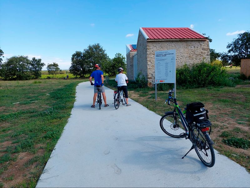
Continue on the D2 at the next roundabout climbing slowly towards Laroque des Albères. After about 1km, on the left you can rejoin the EV8 heading east. Just after this there is a new building which will apparently be an ‘Aire de service velos’ but at the time of writing it was unfinished. It’s not clear what facilities the ‘aire’ will have, but it appears there will be a WC and possibly a café?
Continue to follow the cycle path signs until you reach the village of Sorède. At the T junction with Rue de la Gabarre turn right towards the village centre. In the centre turn right again on the D2 and you arrive back at the start.
Congratulate yourself on a great ride and have a cold drink at the Brasserie des Albères!