WALK THE REGION WITH TED AND KATE HISCOCK
13km 5.5m (8 miles approx.) 3.5 hours
This walk goes over the hills from Port Vendres to the charming quiet hamlet of Cosprons, then on to the Cap d’Ullastrell with views of Banyuls-sur-Mer and then back along the sea fronts of the beaches of Paulilles before returning inland to the Domaine of Valcros and back up to the Coll de les Portes and back down to Port Vendres

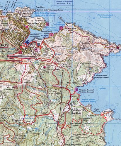
Start at the Market Square in Port Vendres (Place de l’Obelisque). and drop down to the harbour edge following it to the steps by the pizza place and up to the small leisure park, Place Castellane, past the embracing statue.
Cross to the short street, rue des Paquebots, up the ancient steps that lead away to the left and then left at the top to the station and along the first stretch of the Val de Pinte road.
Soon, there is a small tunnel under the railway line on the left and although it does not look particularly inviting, be brave and clamber up the rocky track to the left at the other end adjacent to the railway line looking down on Port Vendres station.
This continues for a few hundred metres and emerges on to a wider cart track where another left turn is taken leading to the busy roundabout on the N914.
Proceed under the bridge, ignore the cul de sac and take the next left up the new road about 100 metres & follow the yellow sign on the right.
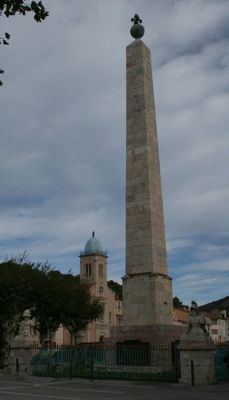
Climb up between dry stone walls. At the top of this moderately steep climb, cross over the D86a and proceed into the vineyards which give views over to the final peaks of France with Cosprons nestling below.
As the track turns sharply to the right continue along it, ignoring any others, as it descends into a small valley and veers to the left, running parallel to a track which the path then joins by a small garden.
Continue descending past a holiday home on the left, and the path steadily drops between the vines to a point where the larger track veers to the right, at which point a narrow one falls away to the left partially obscured by long grass with little to mark its track.
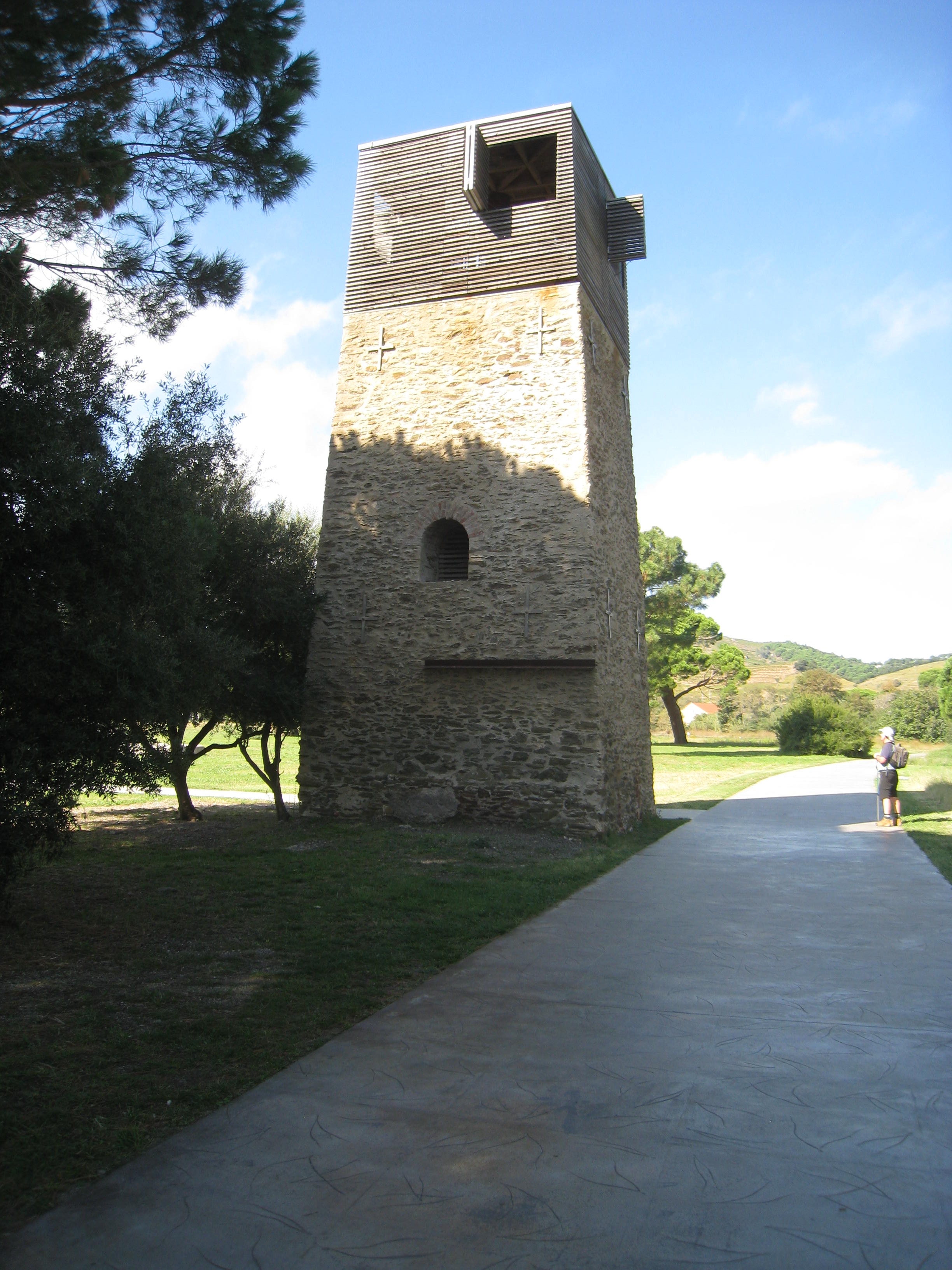
Head down here to the left keeping the Cosprons water tower looming in front. Cross the lane keeping slightly to the right where immediately the narrow path continues down to the ditch and passes the water tower, emerging in the hamlet of Cosprons.
Take the road (D86a) out of the village to the left and then in 1km a yellow flash painted on the kerb stone indicates a turning off down another rugged track where the handsome railway arch over the dried river valley invites the walker to approach.
Immediately under the bridge turn right and a tarmac road starts as it winds the perimeter of the local decheterie. (tip) The side road comes on to the N114 where we take a right turn and ensure the lay-by is taken to avoid the fast moving traffic on this only major road.
Where the layby re-enters the main course of the N114 cross over immediately and on the opposite side a track hewn out of the rock face leads the walker back into the peace and quiet of vine covered slopes and pine woods.
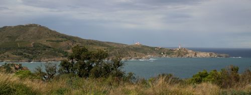
Follow this deserted track for about 1 km as it winds around the hill and then at the T-junction turn right. In about 1km this track comes to a dead end at the top of the cliffs overlooking Banyuls-sur-Mer where the coastal path runs both ways. Take the left limb.
The path drops down to its lowest point where at the pile of rocks with a marker take the path to the left. Drop down to the metalled road with a green gate closing access to vehicles on the left.
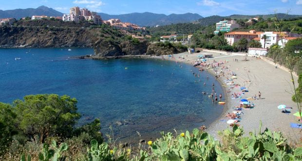
It is well worth taking a short deviation to the right and visiting the ancient quite well-preserved fortress on the headland of Cap d’Ullestrell, Return to the gated part of the road and follow its route along the back of the first beach ‘Platja del Forat’ behind the ugly concrete excrescent remnants of German occupation and then turn right down a small track, seemingly into the concrete jungle.
After heavy seas, sometimes this track is impassable and a detour has to be taken around the other side of the Dynamite Conservation site.
This path leads to the breakwater and access into the Paulilles site can be made across a little footbridge. (There are toilets here).
Continue along the breakwater at the back of the second part of the beach, where restoration of the Nobel Dynamite site is on-going and then at the end, drop down on to the beach itself and cross the shallow brook that terminates this sandy area, moving up stream by about 100m where steep steps take the walker up into pine woods shrouding more concrete obsolescence.
After the Paulilles site has been exhausted (and there is now a lot to appreciate with museum, conservation projects for plants, wild life and encouragement of artisan projects), walk over the thickly planted fir tree promontory separating the two beaches.
The path through the woods hugs the edge of the cliff and then drops down to the third beach that makes up the Anse de Paulilles, where at certain times of the year refreshments can be found.
After the brutal defeat of France during the disastrous Franco-Prussian war of 1870, the Minister of the Interior & War, Gambetta instructed Paul Barbe, (a protégé of Albert Nobel) to construct a dynamite factory.
He chose this to be a good site with criteria being a bay with a river, wells to wash the nitroglycerine, proximity to a port and a desolate site that would not endanger lives – if there were an explosion!
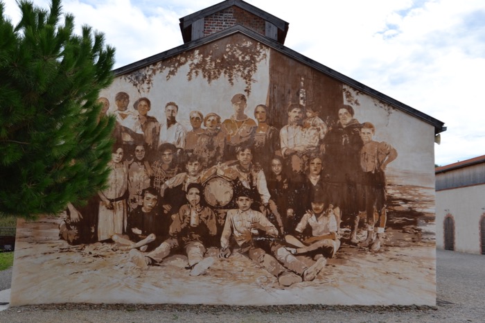
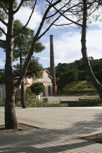
It was prosperous and employed between 300 and 400 workers, suffered occupation by the Germans during the war and now, after many years of dereliction the site has been turned into a developing and imaginative conservation area encouraging artisan creativity. (See “Site classe de Paulilles” published by Conseil General www.cg66.fr 04.68.95.23.40)
 Leave this beach down the track that leads back to the N114, cross over the pedestrian crossing for a few hundred metres before crossing back by second pedestrian crossing and go straight into the gates of Domaine de Valcros .
This Domaine (marked on the map as Mas Pams) is a well respected wine producer being part of the Chateau de Jau at Cases-de-Pene and during the summer months, rooms, meals and a degustation are on offer here.
Enter the main gates and immediately follow the sign for Chambres d’Hote but then proceed to the right of the charmingly traditional farm buildings turning up a wide farm track that ascends the hill.
Almost immediately there is a fork in the track and be sure to take the left limb (marked with a blue ‘L’ flash) which eventually brings the walk out for about 20 metres on the RN114 close to the col.
Once Port Vendres comes into view, the small road to the military zone on the peak of Cap Bear leaves on the right and then immediately another track descends down just below the road which joins the road leading down to the Port du Commerce side of Port Vendres.
Follow this round beneath the precarious ruin of Chateau Pares on the right (a mysteriously compulsive and derelict shell of more glorious days and one suspects wartime tragedy) and return to Port Vendres around the port.