Walk the Region: Les Crêtes de Serrabona
with Tim and Chris Parker
Key Info An invigorating 4 ½ hour circular walk with 680m of ascent. The walk offers wonderful views and some interesting historical/archaeological features. Can be shortened by 1 hour if you choose not to visit the unique ice well. Walking boots essential on the rocky, sandy paths. Walking poles helpful. Head torch for visit to ice well. Route offers shade in early and later sections. Waymarking is yellow and white in parts with unofficial orange spots. Access: map IGN 1:25,000 Céret/Amélie les Bains 2449 OT; Thuir, Ille sur Tet 2448 OT |

Prieuré de Serrabone
Meaning ‘bonne Colline’ or ‘good mountain, the views from this small 12th Century priory are stunning, and well worth the rather torturous but panoramic mountain drive.
It is a fine example of Romanesque art with its cloistered hall, perfectly preserved pink marble carvings of plants and animals sculpted onto the pillars, arches (tribunes) and an indoor cloister also carved from the region’s famous pink marble. A real treat!
Immaculate gardens provide an ideal spot for a picnic, quiet meditation and contemplation.
Religious life wasn’t always treated with the respect and discipline required by Catholic priests. In 1413 Canon Bernat Taillet was ordered to get rid of the woman who had moved into the priory with him and in 1448 Prior Bernat Joer was removed from office for ‘crimes énormes’!
Small admission charge but on “jours de patrimoine” (check with any local tourist office) entrance is free and there are many interesting exhibitions such as lace making and mock battles.

Start
Take the N116 from Perpignan towards Prades, turning left at Bouleternère (end of dual carriageway). Priory of Serrabonne signed from this roundabout. Follow D618 through the village and up the valley to right turn, D 84, to Priory.
From car park walk towards Priory. At entrance to gravelled area footpath signed “Les Crêtes” on right up steps.
The walk
After 20 metres take right fork, signed “Roca Roja”. Path rises steadily uphill, eventually passing through gate to reach more open area and then steeper climb to the crest at 970m altitude (1 hour to this point). Superb view of Le Canigou.

Choice here to go right to peak Roca Roja and the ice well, a little further on, or turn left to continue crest. The first option adds 1 hour to the walk but is well worth it if you want to see the best preserved ice well in the department and have the energy.
Option 1: Roca Roja & ice well
Turn right for 20 metres, pass through gate and follow path behind Pic Ambrosi (on right), to head towards Roca Roja.
After a section of ferns and brush the path rises to summit at 1015m. 360° panorama is stunning.
Orange spots mark the path off the summit, (continuing in same direction) to the Coll. Behind a lone cork oak tree on right is the top of the ice well. Beware – it is 12m deep!!

Not mentioned on the map, this ice well is the best preserved example in the department. The corridor for access, lower down, is about 12 metres long. The stonework inside is in excellent condition.
Retrace your steps over Roca Roja back to where you emerged onto crest. Continue circular route at Option 2.
Option 2: Continuation of circular route
Follow the undulating line of the crest with old electric fence on your right.
After approx. 30 mins pass through metal gate. Almost immediately on left notice a very large flat rock with curious cupules and engraved crosses, Cimentiri dels Moros.
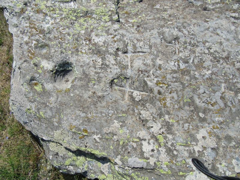
Although this is called the cemetery of the Moors it is not thought to be an arab cemetery but rather the remains of a Neolithic dolmen.
About 20 metres before Le Col des Arques and its stone orri, look out for a cairn on your left, marking the footpath which descends to the Coll de Saleig. Reach Col 20 mins from crest.

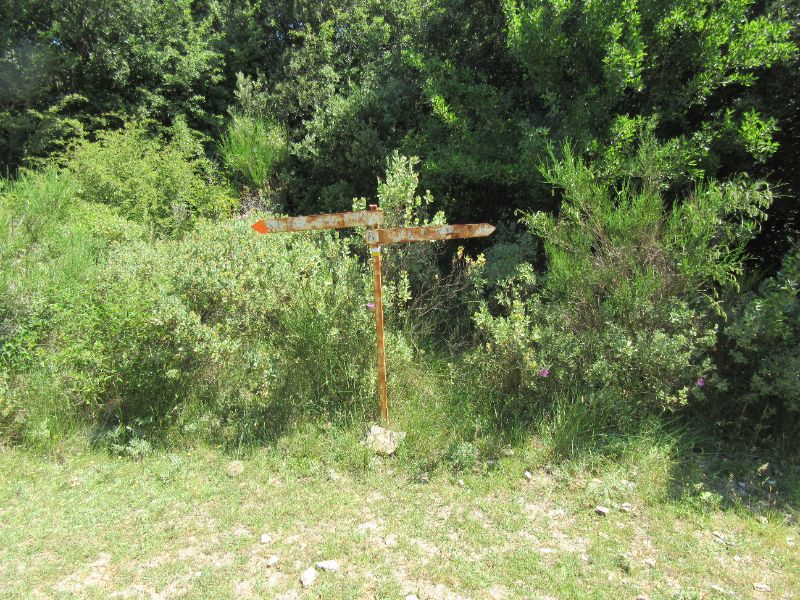
Join a double track and follow it until you reach an old blue camionette. A rusty old sign indicates the route down, to left but Serrabone is also written on the camionette!

Descend to a piste, turn right 20 metres and pick up path on left.
Descend 100 metres to Coll d’Aspic to join ancient path between Boule d’Amont and Serrabonne. Turn left.
Boule d'Amont
The small village of Boule-d’Amont nearby has a pretty cobbled square with old well in the middle, and houses built of exposed stone, but it is really for its church, St Saturnin, that lovers of religious relics should visit.
A magnificent gold alter piece depicting Christ and the four evangelists, an unusual black Madonna, chalices, silver crosses and other treasures make the short detour worthwhile.

Footpath contours round mountainside in shady oak woodland before it drops to ravine (cross stream) and zig zags up the other side to col.
Cross a piste and continue straight on, enjoying the view of Priory from the woods.
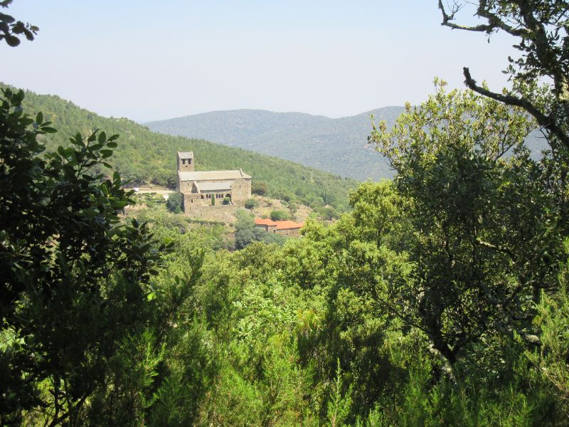
Contour round hillside again to reach the Priory.