Sadernes to Saint Aniol
with Noam
- Length: 14 km return (not including the waterfall)
- Difficulty: Easy -Medium (not including the waterfall)
- Refreshments: Options available in high season but always bring with you
- Points of interest: Old bridges, forests, rivers
This is a full day hike through the beautiful forest and mountains of Alta-Garrotxa, right on the Spanish-French border.
The walk is relatively easy-going and well marked with yellow signs, but quite long: 14km round trip from Sadernes to St. Aniol (this does not include the short walk to the waterfall).
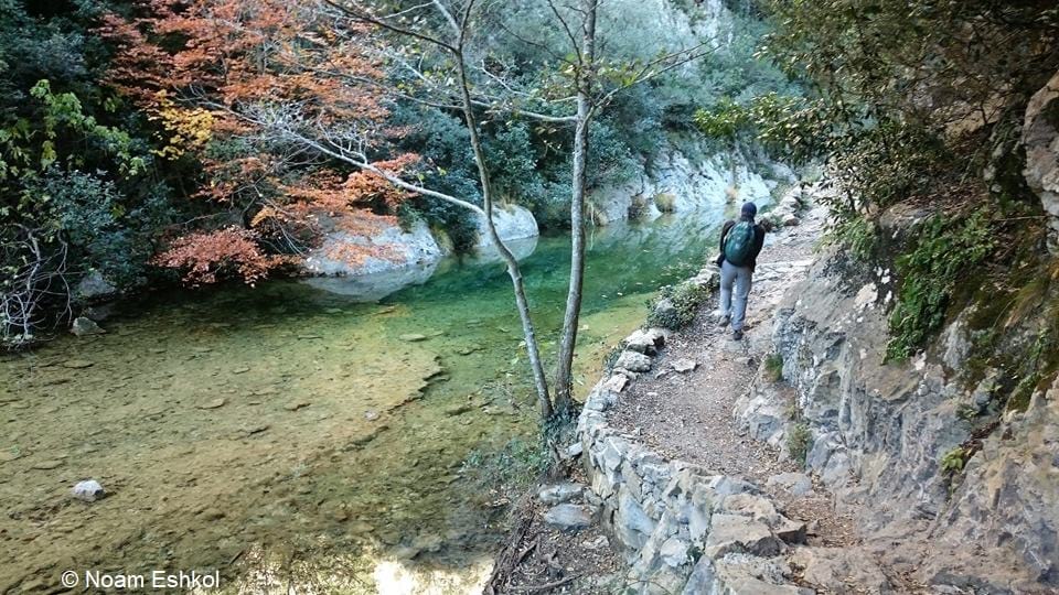
About half of the trail is through the woods and half along the river El-Llierca. There are a few river crossings where you will need to use the rocks as stepping stones so extra care must be taken and in the rainy season, when the river is high, crossing may not be possible at all.
At an energetic pace, but including a picnic in St Aniol, the route takes approximately 5-6 hours.
The official start of the walk is in the tiny Spanish village of Sadernes. In the low season you can continue driving further along the dirt road to shorten the walking distance, but be sure to park in designated parking places only! In the high season the dirt road is closed immediately after Sadernes.
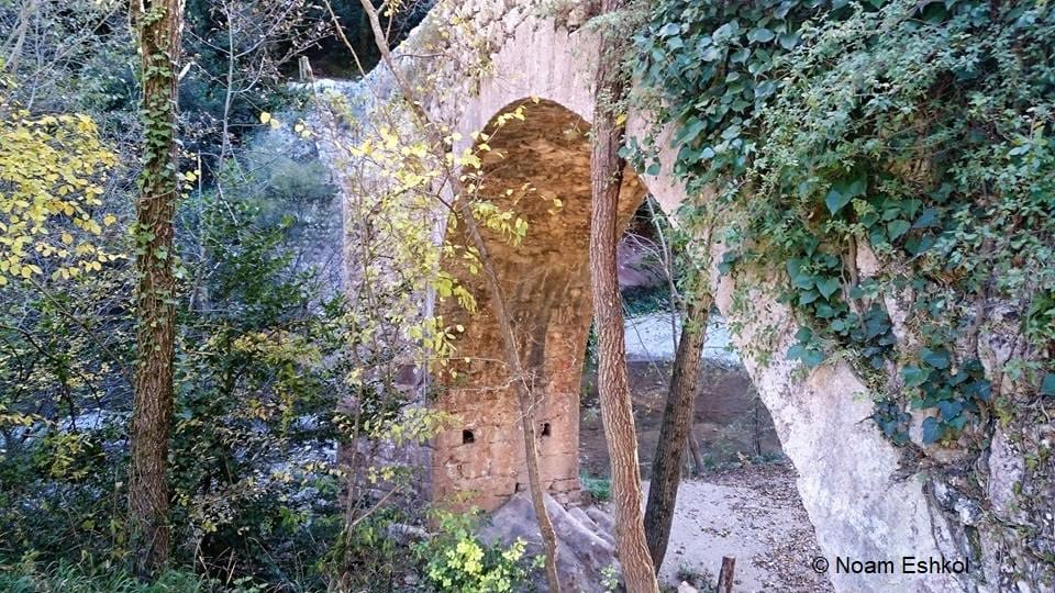
The first old bridge is actually 3.5 km before Sadrenes. It is well worth pulling over for few minutes to admire the Pont Medieval de Llierca.
Parking for the view point is 100 meters along the road, after the view point. Turn left into the dirt road in the woods and then left again. It’s a 1 minute walk back to the bridge on the other side of the road.
The initial walk along the dirt road is beautiful in its own right. At times you walk through a gorge and can occasionally glimpse rock climbers high above you.
When the trail bifurcates, turn left. Cross the river via a second beautiful old bridge and head into a renovated mas which operates as a coffee house and restaurant during high season.
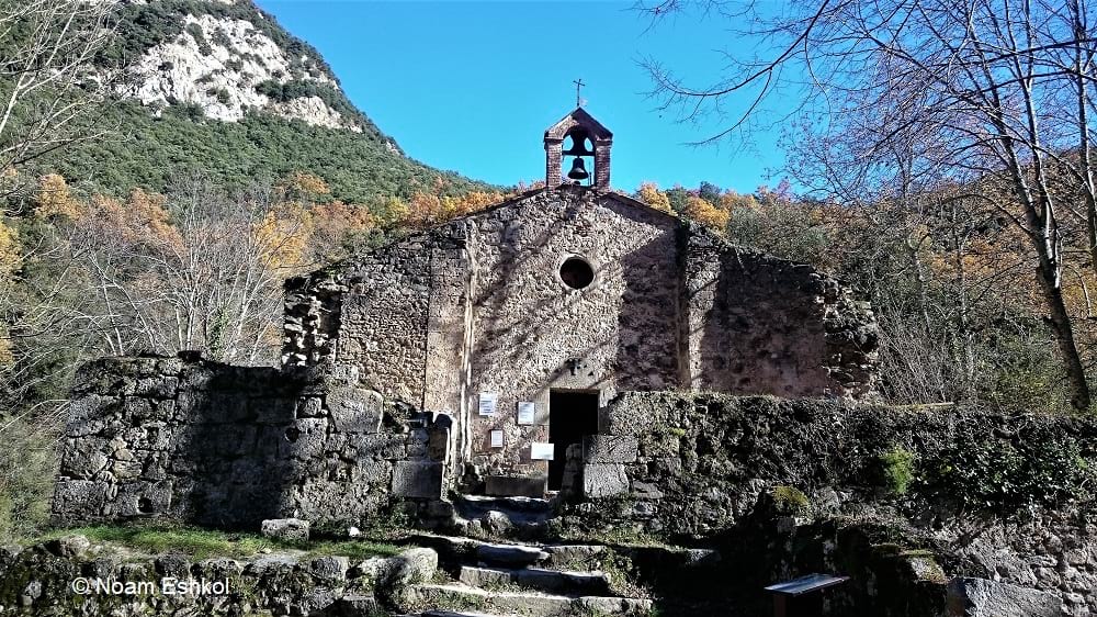
Here the dirt road turns into a narrow path along the river bank, which will lead you to St. Aniol monastery.
St. Aniol comprises of two buildings: the monastery and a large building that is still being renovated to become a refuge for walkers. Works are being done by volunteers so it is expected to take few more years to complete.
You can help by taking a 5kg bag of sand up to the drop off point, where strong volunteers will gladly relieve you of your burden.
In the high season, the monastery and hermitage are open for visits, again managed by volunteers. There are even some basic snacks and coffee on sale! At any time of year, it’s a lovely place to picnic and if the rains have been particularly good, the drinking fountain is operational.
Don’t count on it though- always carry your own drinking water with you!
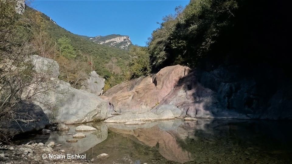
After your picnic you can either head back the way you came or continue for about 15 minutes to a beautiful waterfall and pools. You will see signs on the furthest side of the St. Aniol perimeter.
WARNING: the descent into the waterfall is VERY, VERY steep!
This addition to the regular walk is advised for competent and experienced hikers only. You will need to circumnavigate rocks, narrow paths and other potentially dangerous obstacles in order to reach the pools.
Return via the same route although at one stage, you can merge back onto the initial dirt road, giving you a shorter option than the trail.
Once back in Sadernes, call into the Restaurant Hostal for a well earned coffee, beer, snack or meal.
Have you done it?
Maybe you’ve also done this walk. Do you have any comments or information to add?
Perhaps you’re thinking of trying it. Do you have any questions before you set off?
Let us know in the comments box below or contact author Noam at pyrenees.holidays@gmail.com
Thank you so much for these walk descriptions and guidance. Can’t wait to get home to France to try them.