Lockdown restrictions ease – travel up to 100km without attestation
As of Monday 11th May, the confinement measures of the past 8 weeks have been eased for our region. You can read a detailed breakdown of what this means on a practical level here.
This article is to help you respect the new travel restrictions that state you can move freely and without an attestation within a 100km radius of your home.
To travel more than 100km from your home, CLICK HERE for you smartphone attestation.
Nevertheless, the government is urging residents to use their common sense and keep movements to a minimum.
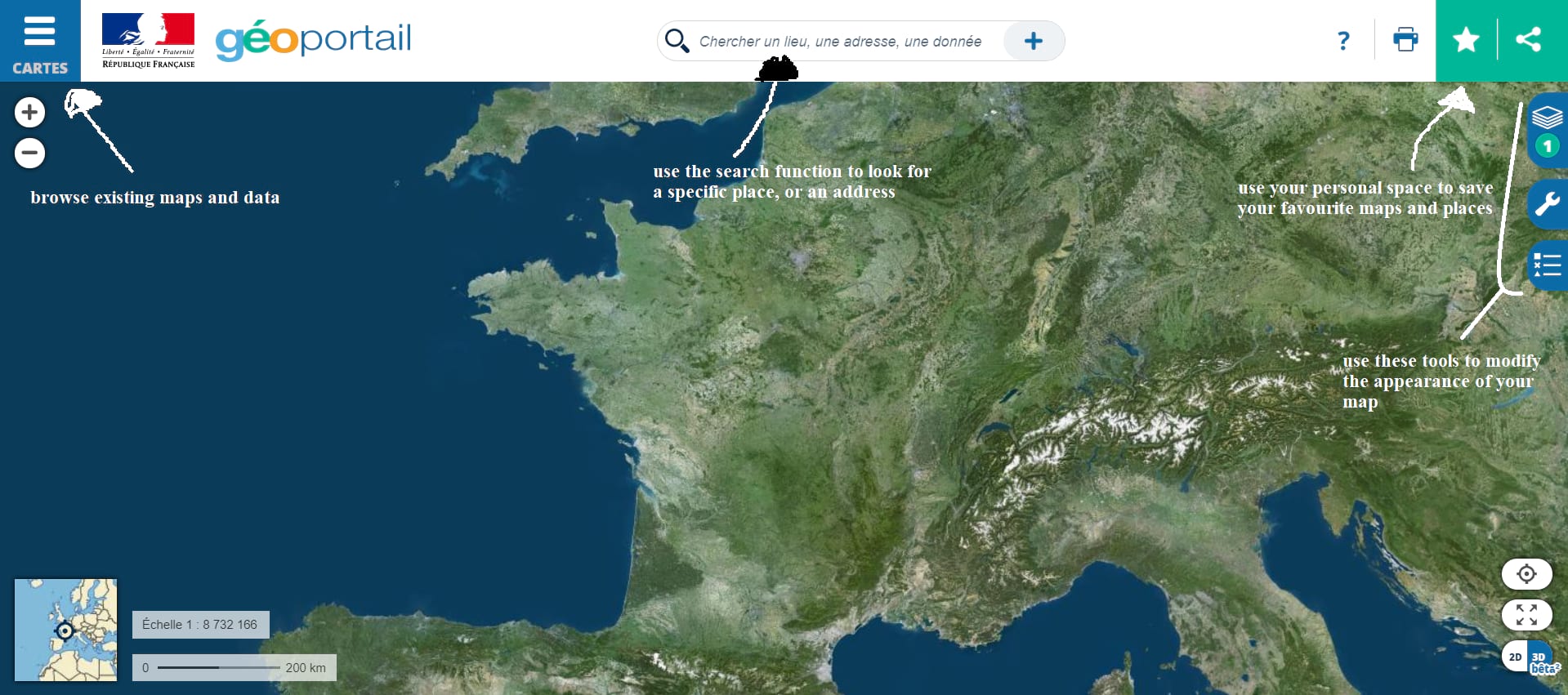
Géoportail
During confinement, the government put in a place a geo-localisation app, for which we provided a step-by-step guide, for calculating a 1km radius.
The process for calculating a 100km radius is exactly the same, but in case you missed the original article, here are updated instructions.
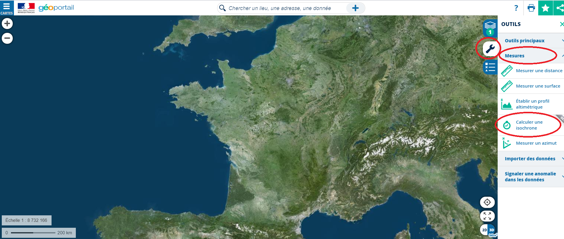
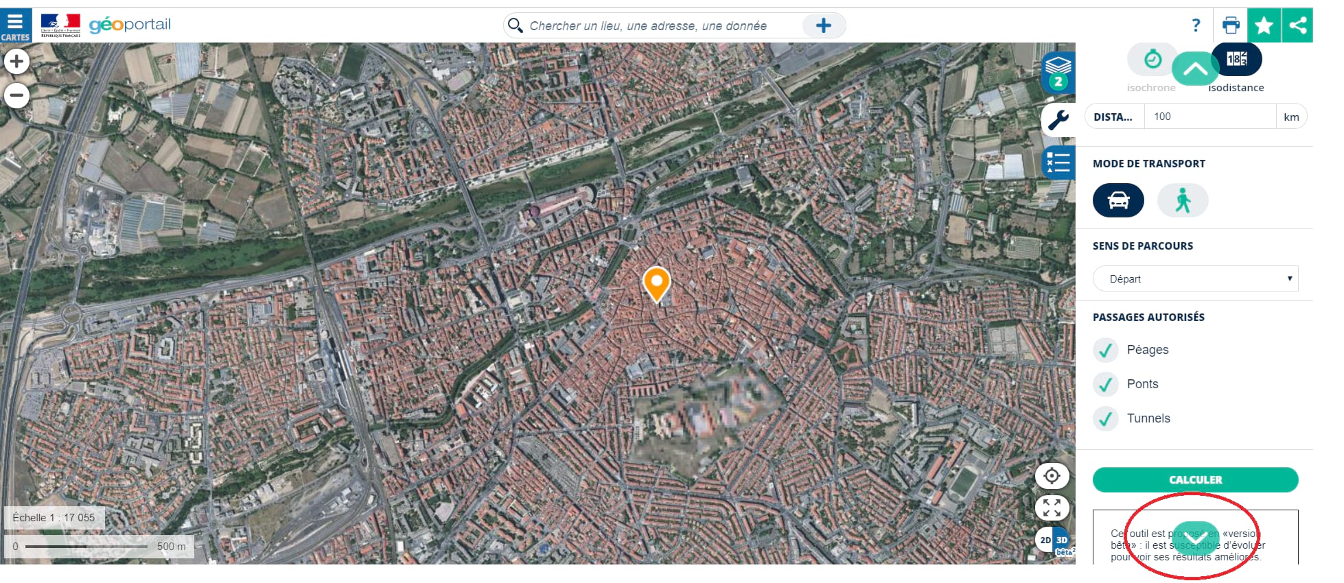
Step 1
To calculate a 1km radius, use the wrench symbol on the right of the screen, then select the ‘Measures’ tab, followed by the ‘Calculer une isochrone’ option
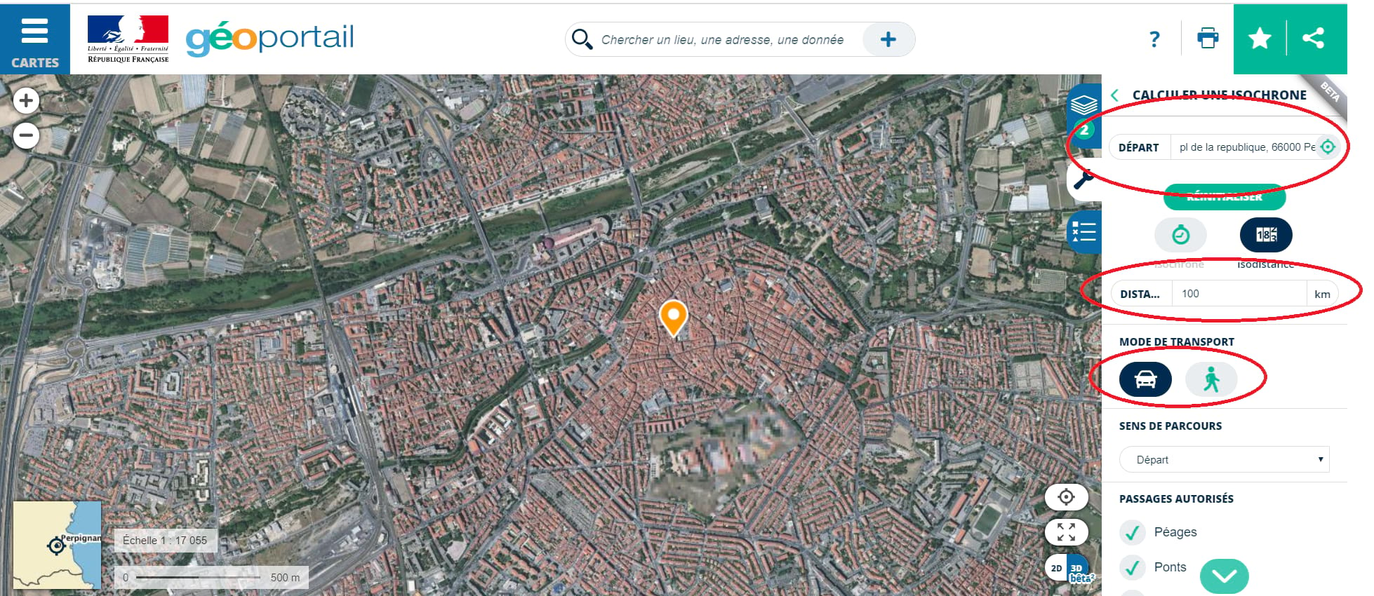
Step 2
In the ‘Départ’ field at the top, fill in your address (you can also directly point to a place on the map using the pointer tool).
Then select the ‘Isodistance’ icon.
In the ‘Distance’ field, enter 100km. Unless you’re a particularly ardent walker, 100km will more likely be something you do in the car, but we’ll leave that decision up to you.
Step 3
Use the turquoise arrow on the bottom right to scroll down for further journey options, including the (de)selection of toll roads, bridges and tunnels.
Then click ‘calculer’
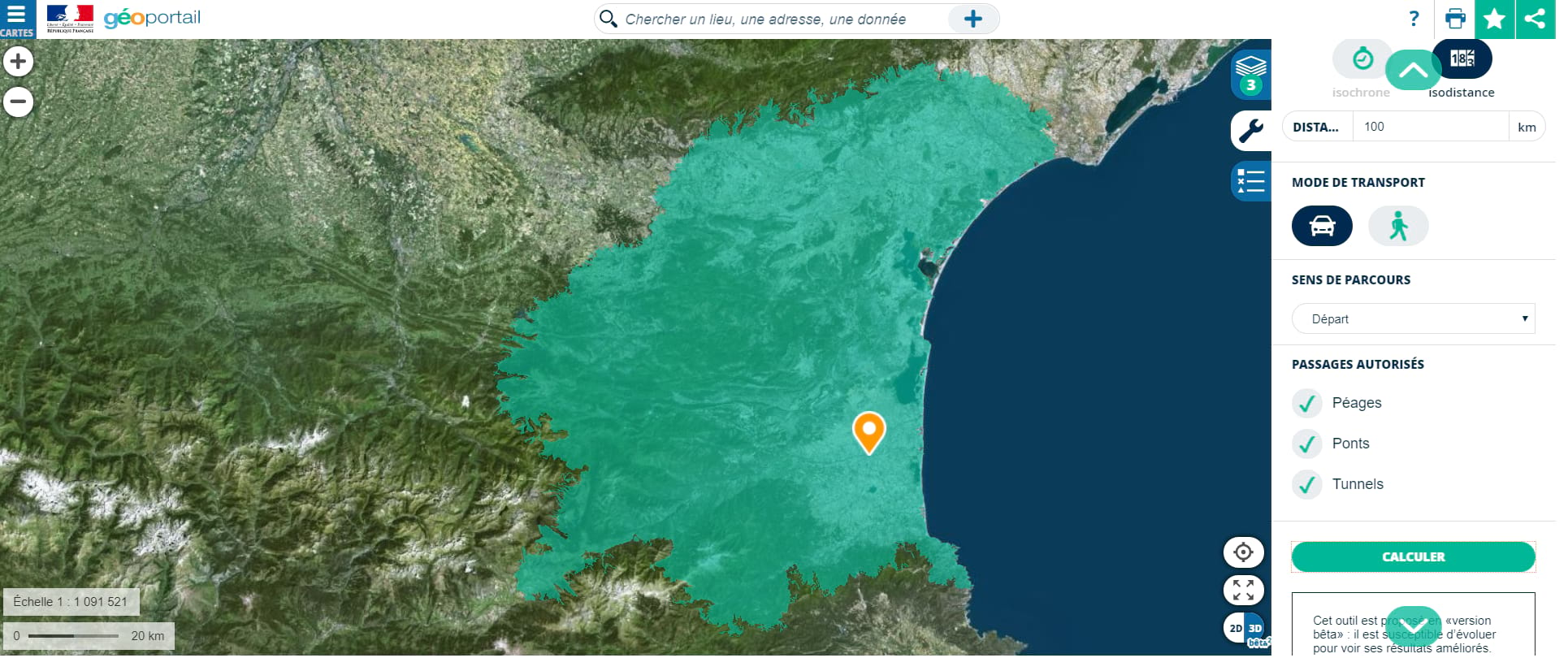
Step 4
On the map, a green zone appears around the address you entered. This zone is not a distance as the crow flies, but rather taking into account road layout and orientation. As a French government tool, it automatically stops at international borders.
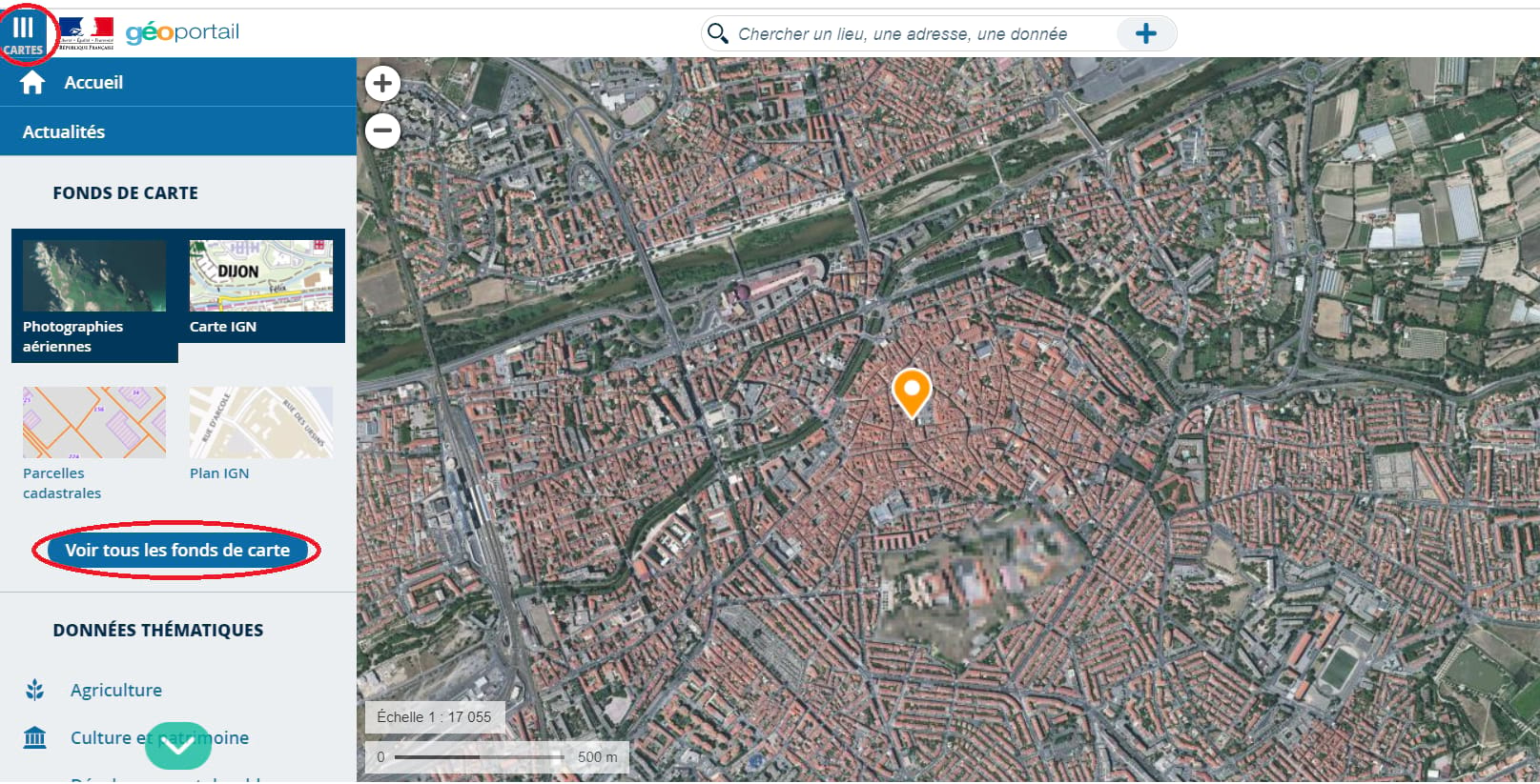
Step 5
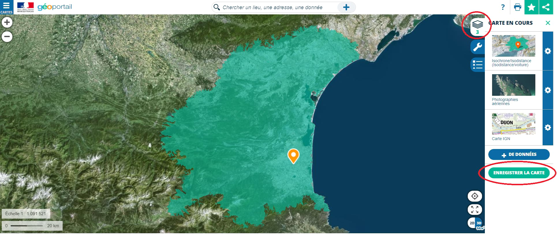
You can change the type of map by clicking the three horizontal lines on the left of the screen. 4 common maps are suggested automatically but you can view all available map formats by clicking ‘Voir tous les fonds de cartes’.
Step 6
Once you are happy with your map, you can save it and reuse it again and again. Simply click on the pile of papers icon on the right and then ‘Enregistrer la carte’. The map will then be available to retrieve as and when you like from your personal space, accessible from the star icon, top right.