Tautavel Tower (La torre del Far) via old quarry
With Tim and Chris Parker
Key info The well marked route to the tower from the village of Tautavel is an A/R of 3 hours, using the same route up and down. This 4 hour, 8 km walk, with approximately 450 metres of ascent offers an alternative for a day when you would like a bit longer walk and have more time. Yellow waymarking on some of the route. Red/yellow on the route down. Walking boots essential and poles helpful on loose stones. Route should be avoided in high winds. Best on a cooler day or with some cloud as there is no shade from the sun. Medium category, with care needed on some scree. Access: map IGN 1:25000 Thuir Ile sur Têt 2488 OT |
Start
From Perpignan follow signs for Airport, take D117 Foix direction. Continue through Casa de Pêne and Estagel. Soon after Estagel, take turning on right (D 61 then D9) to Tautavel. Parking available in the village centre (signed) with overflow parking just after the Cave cooperative – turn right off D9 at far end of village.
The walk
Take path between Credit Agricole and Cave Cooperative, up steps to front of Tautavel museum of prehistory. Continue upwards on the road bending right to cross the open-air theatre. After the theatre take road left, which soon becomes a shaded, stony track signed to La Torre del Far (Tautavel tower) and Le Chateau.
Track goes through cyprus trees and you are soon looking down on the village. About 15 minutes from start the track bends sharp left and passes through a rocky gap with some of the vestige walls of the chateau on right. At this point there is a junction of paths. To the left is the main footpath signed to the tower, which continues upwards, and you will arrive here on the route down.
If you wish to visit the ruins of the chateau, they are up the rocky outcrop to the right, so you can take a look now or on the way down from the tower.
Straight on/slightly right is another unmarked footpath – our route takes this one.
The footpath bends left, then rises after a while, passing to the left of an outcrop of rock, then crossing behind it. Continue to rise gradually and emerge, after 15 -20 minutes, at a waymarked post on a double track – part of the old quarry workings.
Turn right and follow this double track downhill then across the quarry.
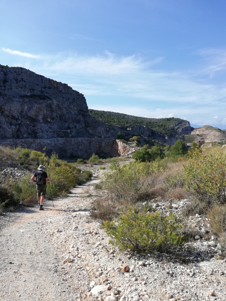
The route across the quarry continues for approximately 2 km. There are high cliffs and deep hollows formed by the old workings.
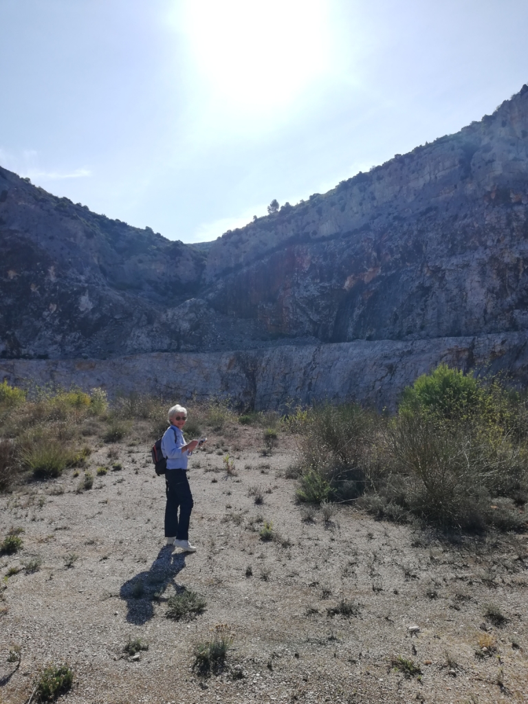
In the centre of the site, pass the local shooting club (club de tir) on your left and continue slightly uphill. Pass some old buildings and eventually the road becomes tarmac.
After about 400m, passing quarried areas on the left and right, reach a bend in the road and look out for a pile of stones/cairn on left. Turn left here up a double track towards a quarried area which you passed on your left on the tarmac road. The track bends right and follows the edge of the quarry uphill. Gradually make your way to the crest leading towards the tower. Yellow waymarking appears once more along the crest.
The path goes up and down along the crest. As you near the outcrop crowned by Torre del Far, the path from Casa de Pêne joins from the right.
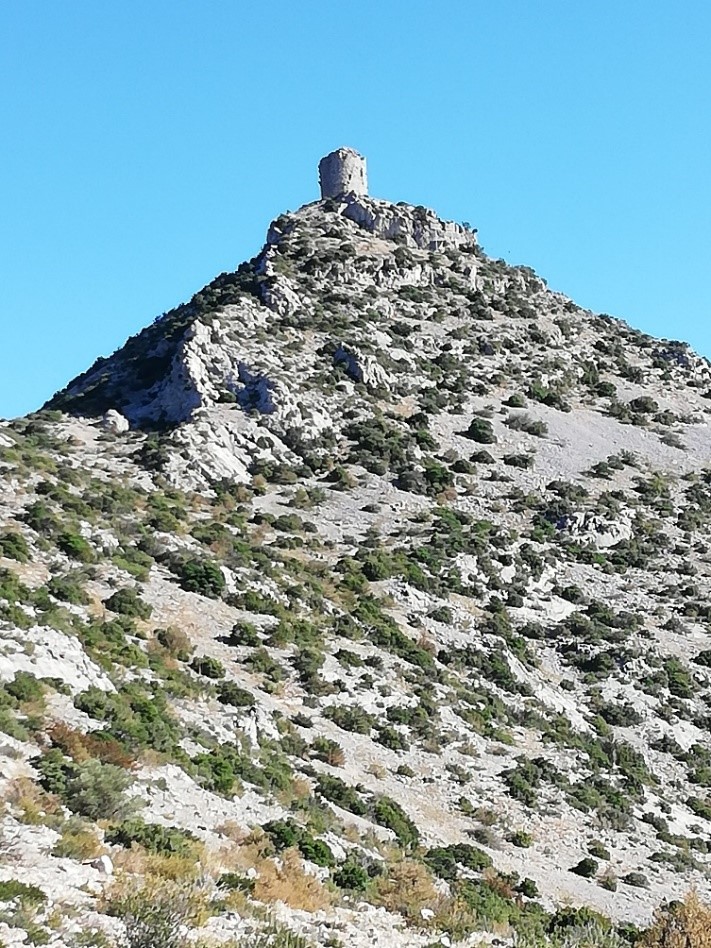
The route to the tower finally rises steeply up in front of you. Take care on the narrow, winding scree path which takes you to the top. Before the final crest, note the path going straight on – this is the way down to Tautavel (red and yellow way marking). But to take in the wonderful views from, and to visit, the tower, continue upwards for a few minutes to the crest, turn right and arrive at the tower.
In good weather you will be rewarded by a 360° panorama taking in coast, le Canigou, les Corbieres with Cathar castles of Queribus and Peyrepetuse and much more! A table d’orientation helps to identify the scene.

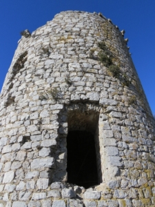
The tower was used from the 11th century to send signals of fire by night and smoke by day in case of invasion from the north. Possibly rebuilt in the 14th century it has stood the test of time and you can enter the door to see the vaulted interior, 5m in diameter.
The tower is 17m high and its walls are 2.5m thick. There were originally a ground floor and 2 upper floors reached by wooden ladders and trap doors. Under the floor is a water cistern.

After exploring the tower and taking in the views, retrace your steps down to join the red/yellow waymarked route back to Tautavel. The path is clearly marked but requires some care in the early part of the descent.
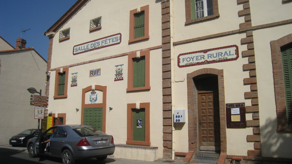
In Tautavel there are fascinating buildings with ceramic frontages, places to eat and drink, a Cave selling local wine and the renowned Museum of Prehistory with it’s fascinating record of Tautavel man (450,000 years old) found in 1969 in the Caune d’Arago above the Verdouble river in the nearby Gorge de Gouleyrous. The museum has audio commentary available in many languages.
A great day out in a beautiful area.