")

")
")
")
")
")
")
")

by Tim and Chris Parker
A 4h circular walk with approx 520 metres of ascent. Well signed route with yellow/white way-marks and yellow signs indicating Les Balcons de Taurinya. Wonderful views of Le Massif de Canigou and its summit and very interesting industrial remains at Les Mines de Salver, near Taurinya. Visit to Abbaye St Michel de Cuxa recommended.
Access: map IGN 1:25,000 Massif de Canigou 2349 ET
")
Take the N116 from Perpignan to Prades. Turn right at roundabout to follow ring road round Prades. At next roundabout follow signs to St Michel de Cuxa Pass through Codalet on outskirts of Prades and park at the Abbey car park.
Start of walk:
- From car park walk uphill behind Abbey. Take path across field, on bend (waymarked yellow and white). On entering woodland turn right.
- Pass remains of Chapelle St Pierre d’Orseleo and continue to a house beside D27. (10-15 mins from start)
- Pass to left of house “La Remise” and turn left onto path through woodland which rises gradually to meet a wide piste.
- Turn left and admire the views on continuing to Col de Clara. (50 mins from start)
- Turn right just before piste to right and take steeply descending path to Taurinya. In valley ( river La Llitera), reach a paved area and the ruins of an old water mill. Cross bridge turn right and up into village.
- Turn right to find old Lavoir then left to D27 through Taurinya.
- Turn left up road in direction of Fillols, round bend, to reach Le Cami de las Tarteres on left. Take this road and after passing a few houses turn right on path which goes gently uphill alongside a stream. Emerge at Gite d’Etape “El Passatje”.
- Turn right up broad track, through a barrier (which may be up) to enter site of
Les Mines de Salver. These old iron mines were worked from 1879 until 1928 then closed when cheap imports came from Mauritania. They were reopened in 1958 but finally closed again 1962. A series of boards explains the history and ways of working. Many vestiges remain.
- First pass the site of huge hoppers used to load minerals
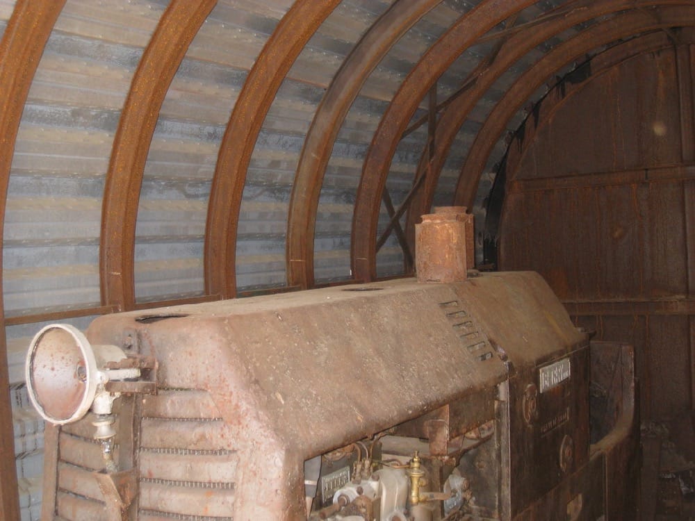
- Then rise steeply to turn right onto level track bed of old railway. Contour hillside to entrance of mine 703, so called after its altitude. The track goes in 50 metres and leads to 700-800 metres of galleries. An old locomotive still stands behind the entrance grill.
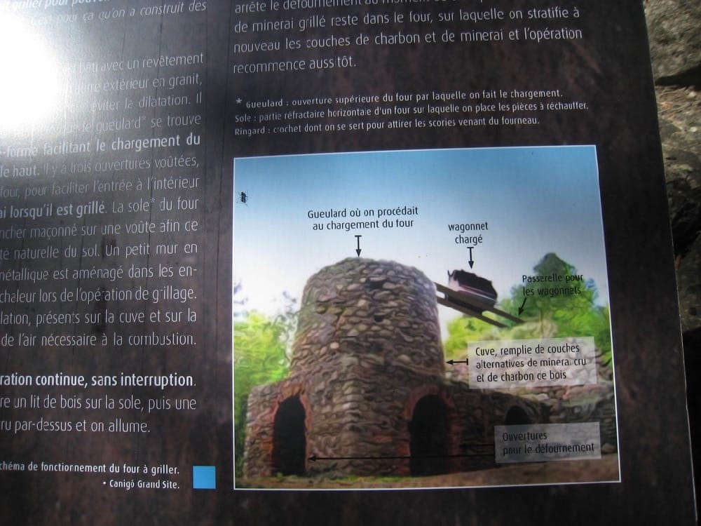
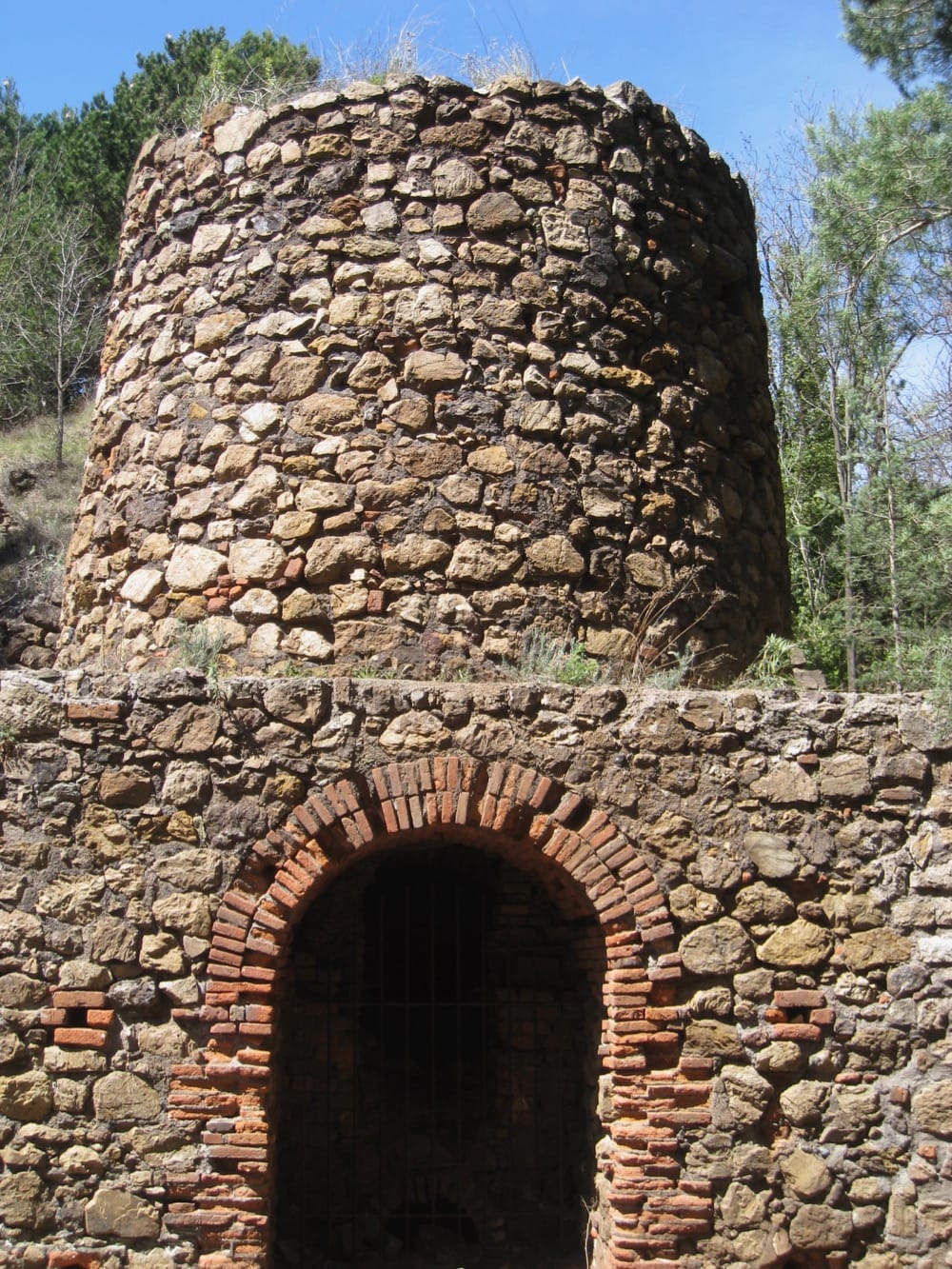
A very steep incline, formerly site of a mechanised lift, leads up to the first grill oven, which heated the carbonate containing iron. Continue up to the remains of miner cottages and a larger oven. This is a lovely picnic place.
- From left of the site a path rises steeply past an old truck to reach a bifurcation. Turn right.
- Contour then climb upwards over ground showing evidence of mining over centuries. Rise to crest of hill, emerging from woodland to descend to meadow. Scene becomes alpine.
- On this Col take right turn down grassy track beside fields with goats . Look back at superb views of le Canigou and its Massif. Arrive at D27, turn right and descend for 400metres.
- Just before entrance to farm (and unless you want to call in for some goat’s cheese!) take broad path on left to reach T junction. Turn right and very soon left to arrive at Le Tour de Corts. Le tour/donjon and one other building are all that remain of an old mining village.
- Take broad path left off the site. Descend into valley for approx 1 kilometre. Just after site of “tented” accommodation a footpath on left leads to le canal de Bohere.
Le canal de Bohere is the longest irrigation canal in the department – 41 kilometres from Serdinya to Marquixanes. However, it was only used from 1879 -1933 and became redundant because of improved methods of taking water using pumps.
- Follow the old canal to crossroad of paths. Turn right – signed “Le tour de St Michel”. Drop to river Llitera and follow it to cross a wooden bridge and find the car park.
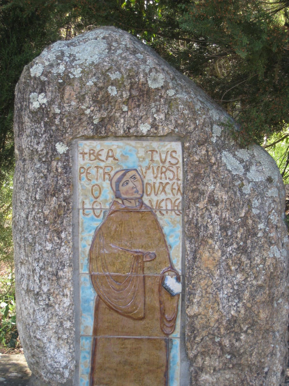
Abbaye St Michel de Cuxa was started in 956 and consecrated in 974. It is the biggest intact pre-roman church in France and has been substantially renovated. MORE
Hello. The bridge before entering the village is closed so I would start this walk in the village.
The goat cheese farmer does not exist anymore. But in the village is an Epicerie who sells some local products
Thanks Mendy. That is really useful to know