Porteille de la Grave 2426m from Lac de Bouillouses.
with Mike Rhodes
UTM Grid WGS84 – 31N 418168E 4712375N – 18k, 6 hours and 455m of ascent
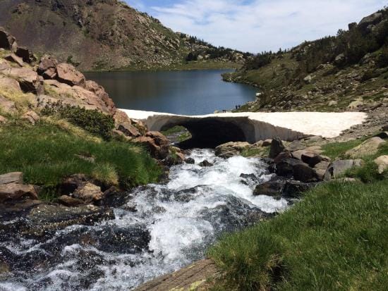
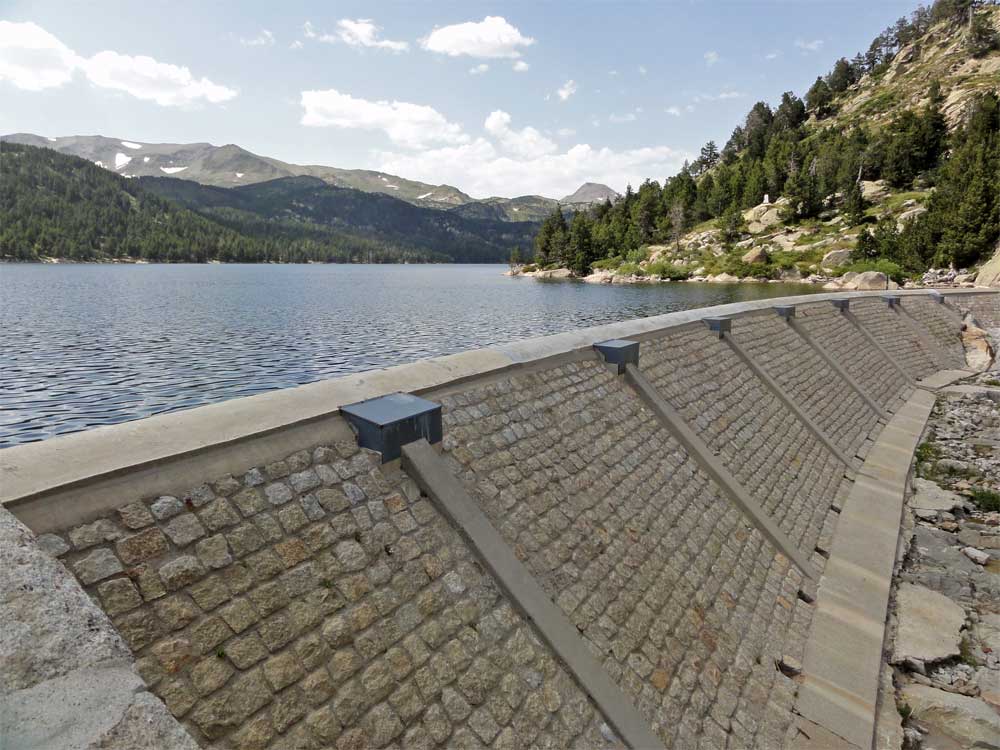
Starting from the barrage at Lac de Bouillouses, 2005m, built 100 years ago to create the lake and supply power to run the Train Jaune, this walk follows the route of the Tet river as it flows down the glaciated valley of the Coma de la Grava.
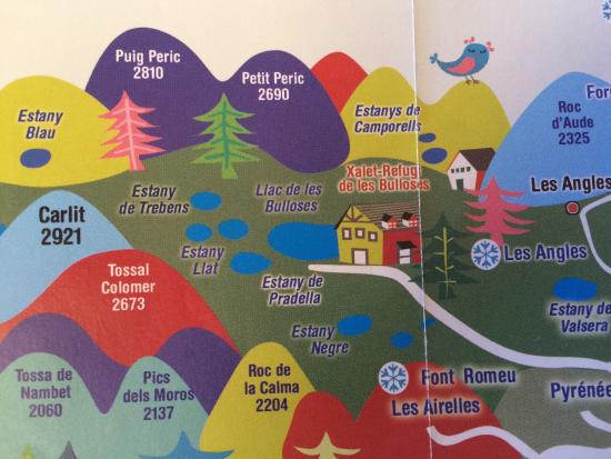
Today the artificial Lac de Bouillouses is an important water reserve (16 million m3) but also one of the most beautiful lakes in the area.
Access
Take the D118 Les Angles road from Mont Louis, for 1.5k until you see a sign for Barrage de Bouillouses.
In the summer school holidays the road is closed to cars after 1.6k, just after the camp site. You will see a large parking area on the right where the navettes depart.
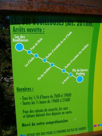
The cost is around 6 euros (2020 price) per person for the uphill trip. Coming back is free!! (Dogs allowed but must wear a muzzle)
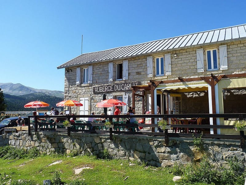
The navette drops you by the Auberge du Carlit (great place for a beer at the end of your walk) where you can cross the barrage.
The walk
From the far end of the barrage turn right, North, and follow the well marked path, through the forest, by the side of the lake.
The path is marked with white and red dashes, identifying the route as a “Grande Randonnee” and it is in fact part of the Cross Pyrenees GR10 route.
Although the path generally follows the lakeside, it is far from flat, climbing and descending small knolls and crossing several stream valleys.
After 3k (1 hour) exit the forest into pasture land and the path splits. The RH route follows the Tour du Capcir, but we continue on the LH track and climb into the Coma de la Grava.
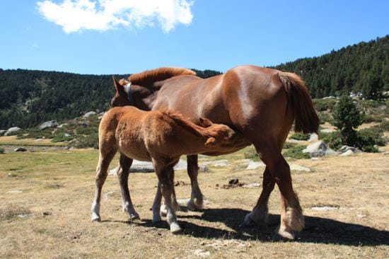
We have only reached 2030m at this point but it feels a lot more. Our chosen route continues to meander gently up the valley for a further 4k to a height of 2150m. Stay on the LH side of the stream before turning westwards and climbing into a higher valley at Estanyol where wild horses can often be found grazing. This valley is a favourite training ground for helicopter pilots and it is not unusual to see the bright orange rescue copters from Osseja doing their low flying exercises.
At Estanyol, the stream that feeds the source of the River Tea from the left, comes down the slope from the left but ahead of the Porteille de la Grave looms up at the head of the Coma.
Cross the stream to the RH side of the valley start to climb the final 700 m distance and 130 m height gain to the Col, following an ever steepening rocky path. Early in summer, banks of snow tend to accumulate in this east facing Valley so take care. The snow slopes can be avoided by taking the rocky slope to the right.
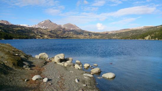
As you approach the col, the slope eases and a stunning view explodes before you. Way below is the Etang de Lanoux, subject of a dispute between France, and Spain when, with a building of the barrage, water was diverted north to Toulouse, instead of flowing into the Segre and into Spain. Being the Lanoux rise the towering Twin Peaks of Puig de Coma d’Or, 2826 m and Puig Pedros 2842 meters, both involving a scramble to the summit.
The western side of the col provides a superb picnic site where you can also watch the fully loaded GR 10 walkers labour up the steep slope from the west.
For the fitter walkers, it is a simple, but steep option to climb the Puig de la Grava 2671m.
We return on the same route but the views are totally different, and the prospect of a cold beer at the Auberge becomes more and more appealing.