Walk the Region: with Leigh, Merry and the Three (Cap) Béars
Key info It’s shocking to think that we first did this walk almost 15 years ago! It was well overdue for another look, but we’re not quite as sprightly as we used to be so we decided to split the walk into three circuits. You can still do the whole thing in one go (8km, allow 3-4 hours, about 500m ascent/descent), but we found there’s so much beautiful scenery to see on each section we were happy to spread it over a few days. Sticks and walking boots are recommended for all these circuits. Map IGN 1:25000 Banyuls/Col de Perthus/Cote Vermeille (GPS) 2549 OT |
Cap Béar Walk 1 : Port Vendres to the Cap Béar lighthouse
Medium difficulty, (5.8km 1½ to 2 hrs, ascent/descent about 200m)
Start
Drive around commercial port towards Cap Béar. Park at camping car area behind Hotel des Tamarins or, if full, park up the hill at Redoute Béar. Start on Chemin des Tamarins and pass between hotel and hill on which Redoute Béar sits. Arrive at Poisson Rouge restaurant and ruins of Redoute Mailly.
The walk
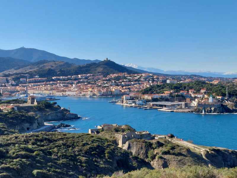
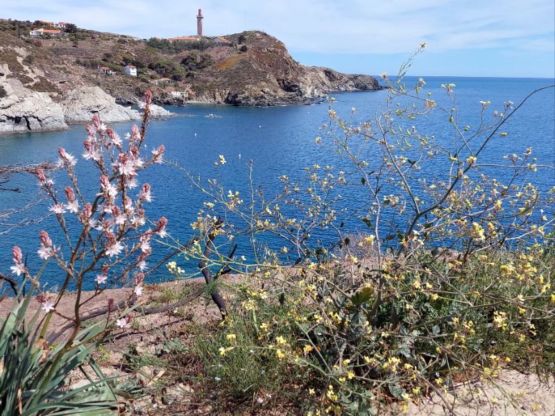
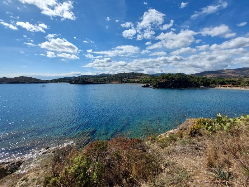
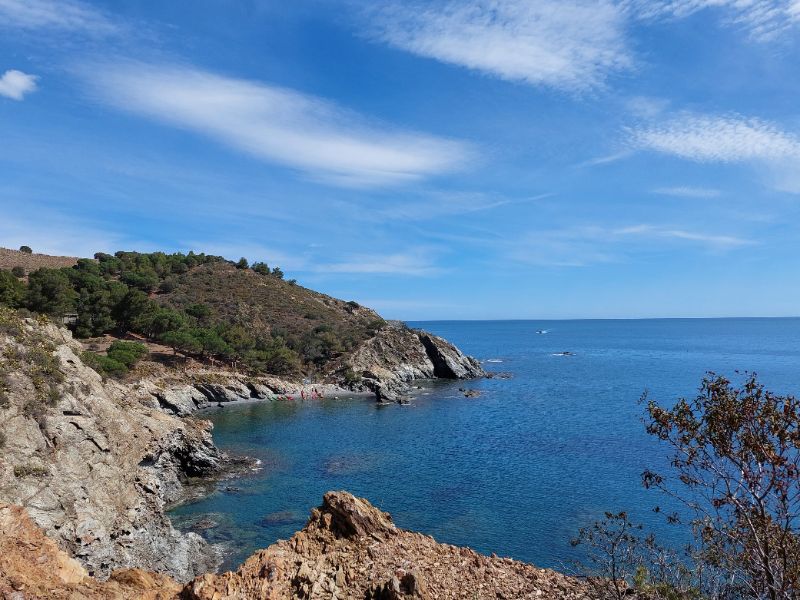
Eventually after 750m, reach Anse de l’Espeluga just before southern harbour wall. At 509830E 4707620N the footpath climbs, quite steeply in places, towards the road to Cap Béar, yellow marks throughout, and great views back over Port Vendres.
Cap Béar and its lighthouse is an emblematic landmark of the P-O coastline, a historical monument, proudly protecting the beaches around Port Vendres since 1905.
At 79m above sea level, this iconic building is as eye-catching on the inside as it is on the outside, its spiral staircase constructed from marble from Villefranche de Conflent and accentuated by opal blue walls.
For the time being, the state-owned and military-run lighthouse with its spectacular view is not open to the public….but watch this space as the government looks to sell the site to the ‘conservatoire du littoral’, who hope to open it up to all.
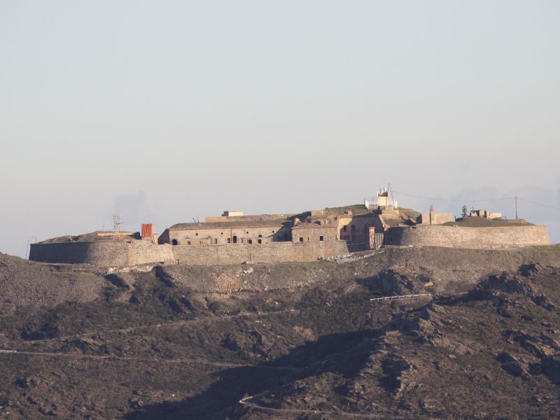
After 350m, reach the road, and a signpost to the left where the footpath continues to climb to right. After about 100m more climbing, the path turns left along the hillside, looking down over road and cliffs to sea below, with Fort Béar above.
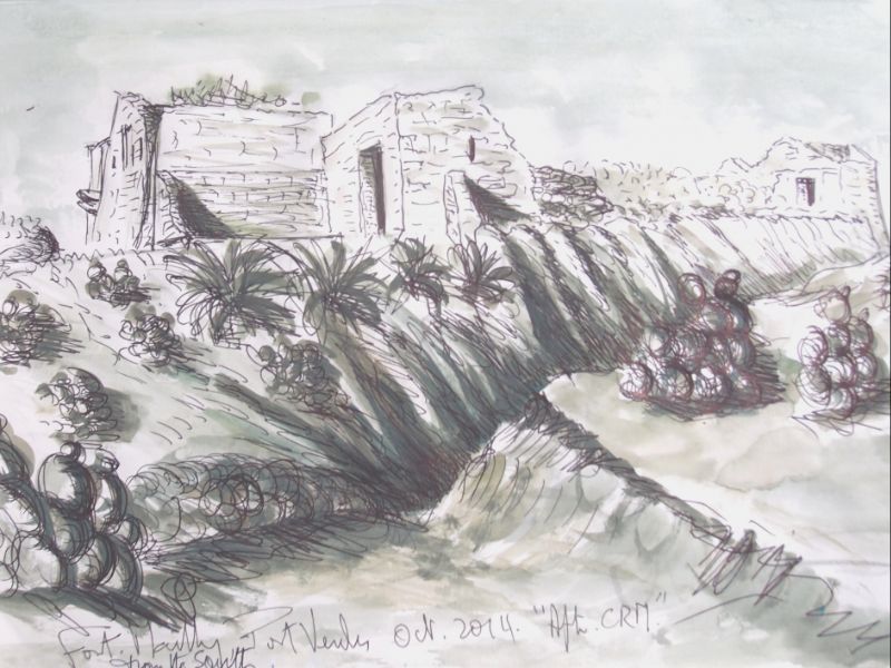
Built in 1883 to protect the French border, Fort Béar sprawls across the top of the headland, looking more like a tourist destination than an active military installation. It played a key role protecting the Paulilles ammunitions factory during WWII and still belongs to the military today.
Occasionally the public is allowed inside on the Journée du Patrimoine heritage days.
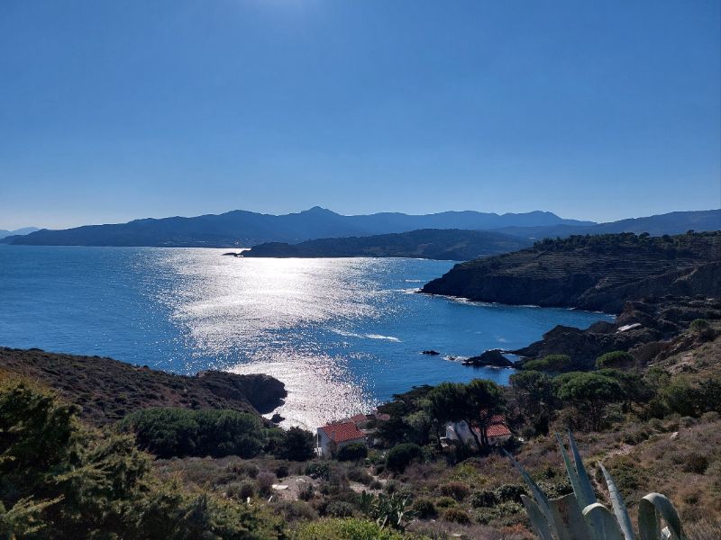
Continue for about 650m until you come to crossroads of footpaths at 510510E 4707020N. Turn left, down towards 1905 Phare de Béar, the last lighthouse before Spain. The footpath joins paved road to the lighthouse, so you can concentrate on admiring view to the south towards Banyuls and over stunning bay of Paulilles.
Take a break at the lighthouse, have a sandwich and enjoy the panorama. Coming back is easier, as it’s all on road, still very pretty and much easier. From lighthouse, instead of returning to start you can also continue along coast path towards Paulilles, but we’ll come to that later.
The next two circuits both start and end at Paulilles. If you can, park at the free spot just after the railway bridge. You need to go under the old one on the right, there are a few shaded spaces under the trees. If that’s full, use the car park a little further on at the roundabout to Cosprons.
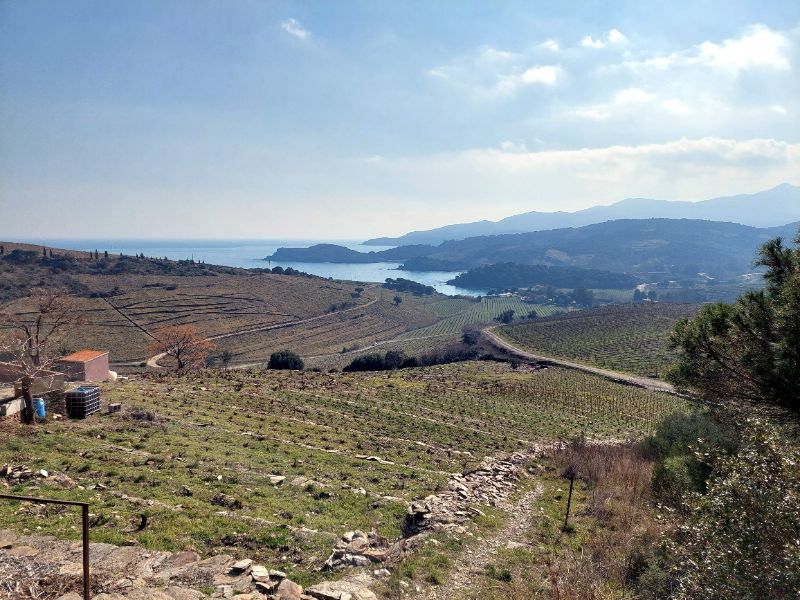
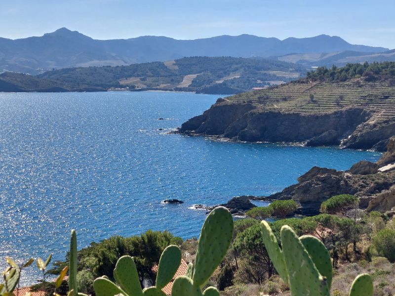
The bay of Paulilles consists of three beaches (Bernardi, del Mitg and Fourat) separated by rocky headlands, surrounded by steep and endless vineyards, and rugged mountains.
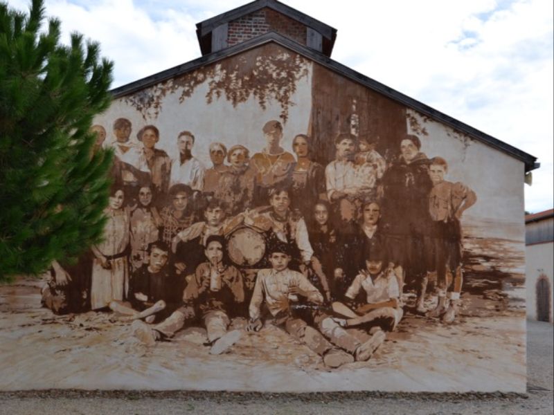
Sheltered by both the Béar and Ullestrell headlands, and protected by Port Vendres fort, chosen for its unpopulated position, the site was perfect for the Nobel dynamite factory. Today, a free industrial heritage museum explains the fascinating history of the site, picnic spots provide vast views over Med and mountain and large sepia murals on several of the restored buildings are a fitting memorial to the explosion victims and dynamite makers of Paulilles.
Cap Béar Walk 2
The second walk is quite easy (4.8km, 1 to 1½ hrs, ascent/descent 110m).
Start
Start at entrance to Clos de Paulilles restaurant and wine domaine. Follow road towards old three-roofed stone building that features on winery’s bottles.
The walk
Bear right up road passing buildings and head up into vineyards. A fork to the right is marked private, so don’t take that one! Continue up road as it turns slightly left towards top at Col de les Portes, where it meets main road just under 1km from start.
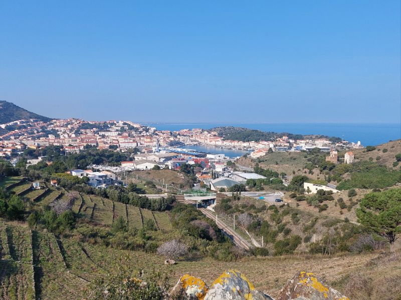
At Col de Les Portes, you can get a great view down into Port Vendres, and perhaps see them unloading fruit from the huge ships that arrive from South America and all over the world. If you want to descend into Port Vendres there is a path, just below and to the right of main road, that joins up with D86b which you can follow down to port.
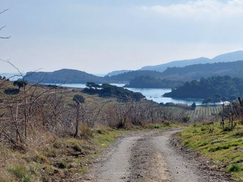
To get back to Paulilles, turn right at top and follow road past small car park. A sign says straight on is military property, and access is interdit, so take track on right, down and past a few small villas, following contours below private road.
After 900m at 510290E 4706580N come to little stone hut on ridge, a good place to stop for drink and admire views over the vineyards and down to bay below. The track turns east around hut towards headland, and after 400m at 510650E 4706620N come to a right-hand bend where a footpath meets track from your left. This footpath goes to Ansa Santa Catarina below the lighthouse, so if you want to join up with first walk, this is one way to do it.
Assuming you want to return to Paulilles, continue southeast down dirt track, which meanders through trees and vineyards with occasional villa dotted about. There are a couple of places where footpaths join up with the main sentier littoral below, but if you like to look at the scenery rather than where you’re putting your feet, walking on the dirt track is easier and gives you almost the same beautiful vistas.
After 1.3km come to a ruined stone building overlooking the vines. Shortly after, at 510170E 4706070N, choose either to go right and loop up through vines and down other side of the valley, or left down past trees joining up with coastal path below where it descends to the Plage Bernardi.
If you’re hungry or thirsty, the Clos de Paulilles serves very nice tapas and wine, and you can sit on the lovely terrace surrounded by vines. If not, just continue along beach 200m and take beach access road back to the D914 and return to your car.
Cap Béar Walk 3
The third walk is medium difficulty, (4.2 km, 1½ – 2 hrs, ascent/descent 148m) It’s a combination of marked sentier littoral and dirt track described in second walk.
Start
Start at Plage Bernardi and follow yellow marks along coastal path.
The walk
The path climbs up and down between the many delightful little (and not-so-little) coves tucked away along southern shore of the headland, where you can stop for a picnic, or a swim in the sparkling clear water if you’re so inclined.
It is a little steep and narrow in places where it’s worn away, not ideal for those bothered by heights, or for small children. It can also get very busy at weekends, so avoid those if you can.
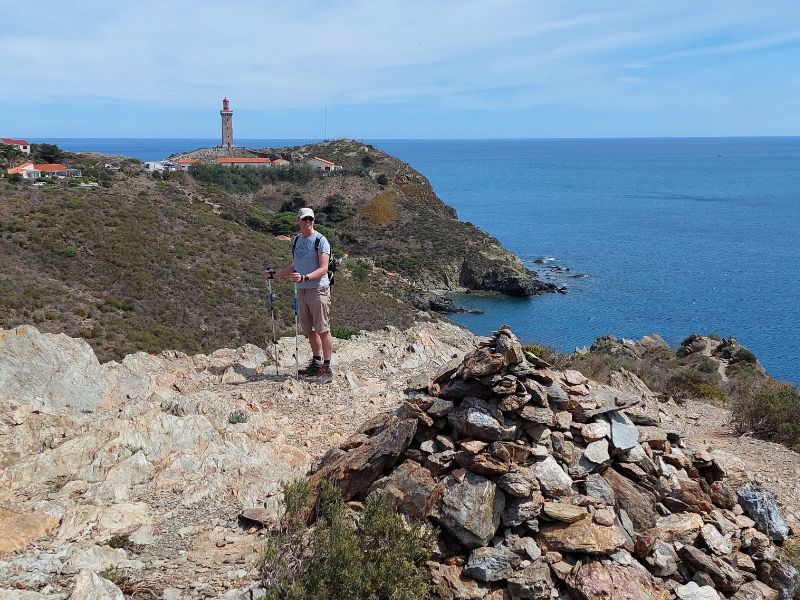
After 1.6km, just to left of path at 510770E, 4706840N there is a pile of stones which marks a crossroads. Here you get a great view of the lighthouse perched on the headland. You now have two options, either to continue following coastal path and go down to Ansa Catarina then up to the lighthouse.
Or you can return to Paulilles via a sharp left turn, and take footpath, described in second walk above, which joins the dirt track returning to Plage Bernardi.
However you do it, safe walking, enjoy your day out and why not tie it in with a bite to eat chez one of our advertisers?