Bike the region: over the border with the Pirinexus
with Chris Bratherton & friends
This 350km cross-border cycle loop passes through 53 towns and villages, including our beautiful P-O, the Costa Brava, Girona, the volcanic Garrotxa region and the Col d’Ares above Prats de Mollo…
A diverse potpourri of beautiful scenery with restaurants, wine tasting, ancient roads and railway tracks, castles and abbeys, fascinating architecture and ruins… a heady cocktail of fresh air and exercise.
Car-free and low traffic with 175km of additional signed detours to points of interest that you can add to lengthen your tour. We have concentrated below on a 4 day tour but taking longer is a great way to ride in the mornings and have all afternoon to explore.
Chris recommends...
…a touring / gravel / hybrid bike to allow you to carry bags.
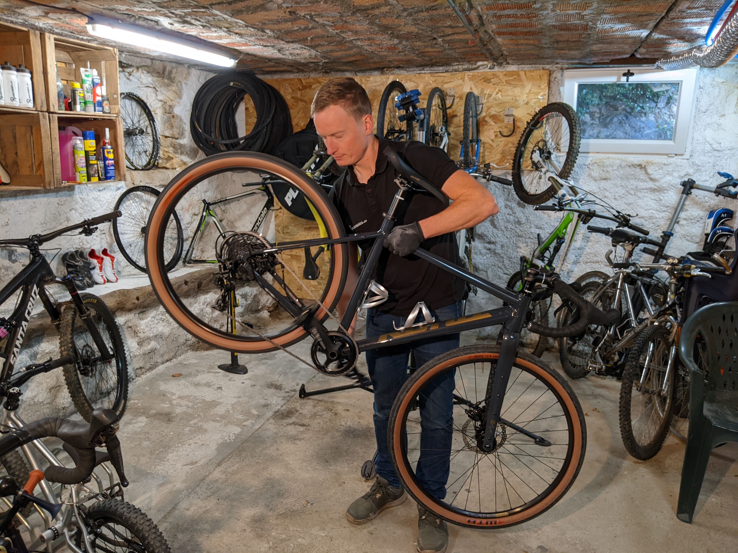
The most popular direction is clockwise, as you descend the steeper gradients of le Col d’Ares (Prats de Mollo) and if there’s a Tramontane wind, you should have it behind you from Céret to the Costa Brava section.
From snowy peaks to sunbathing on the Med, via steep mountain and flat coastal roads. Pirinexus is great for leisure cyclists, ebikers and even families.

Section 1: Céret to L’Escala (80 kilometres)
Tarmac climb from Maureillas to the Col de Panissars where the off road descent begins just behind the small military cemetery.
This is the most technical part of Pirinexus with loose surfaces and steep ramps following storm erosion, so you may want to re-route through Le Perthus on the main road, but if you’re up for the challenge this section is both beautiful and rewarding to cycle.


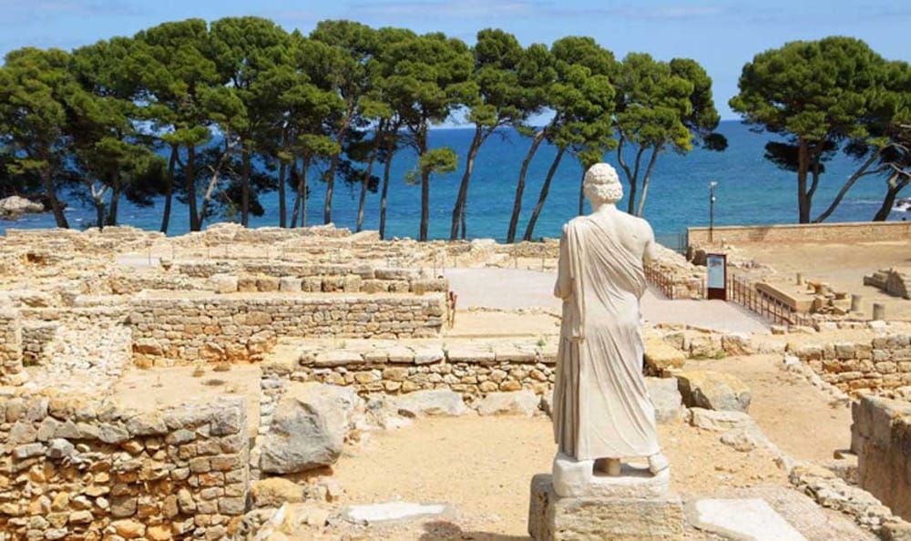
Through La Jonquera, a short but punchy climb takes you back out onto to beautiful rolling tracks of the Emporda wine-growing region. The villages of Capmany and Peralada are good options to stop for coffee (or wine), then ride next to the sea on the coastal path at Sant Marti d’Empuries past the fascinating archaeological site of Empúries and onwards to L’Escala, the end of the first section of the tour.

The fascinating ruins of Greek and Roman cities, and the stone remains of the Ancient Greek sea port built around the 1st century BC are thought to be only 25% uncovered, after having been abandoned in the 3rd century AD and disappeared beneath the dunes.
Section 2: L’Escala to Girona (90 kilometres)
Cycle along flat, fast rolling trails, through acres of apple farms, alongside rivers teeming with wildlife, and back out to the coast again. In Torroella de Montgri, cross the Ter river towards Palafrugell.
Keep your wits about you where the bike path takes a one way street against the direction of the cars – although traffic and cars are in a minority on this adventure!

Along the superbly-surfaced old narrow gauge railway trail towards Palamos, follow the Med to Platja d’Aro, Sant Feliu de Guixols, then inland on the Ruta del Carrilet bike path, direction Girona.
The old narrow gauge railway has been surfaced with a compacted sand, a 40km, car-free bike path from the beach to central Girona without sharing a single kilometer with a car!
Some of the old stations are converted into cafes and bike charging stops, there are tunnels that take you under main roads and the wide trail is safe for families and children.
Girona is very bike orientated with bike cafes, shops, mechanics… Take a hotel in the old town but book in advance!
Section 3: Girona to Olot (60 kilometres)
Another disused railway, the Carrilet, runs from Girona all the way to the volcanic town of Olot. This section is pretty much constant climbing all the way from 70 metres above sea level to 440 meters but with an average gradient of only 1.5% (according to viasverdes.cat), it’s not as strenuous as it sounds.

From the Girones region into the Garrotxa, the hills become taller and a lush green – this is volcano country. If you have time, take a detour to see more of the Garrotxa Volcanic Natural Park.


Section 4: Olot to Céret (90km)
This is the leg for the climbers, to complete the clockwise loop back over the Pyrénées into France; high mountains, border crossings and a great sense of achievement… but easily split if it sounds too much.
Have a good breakfast as the climb from Olot to the Col de Santigosa climbs over 600 vertical meters on a long and beautiful ribbon of twisting tarmac with very few vehicles.

The descent into the medieval village of Sant Joan de Les Abadesses is spectacular.
No posh Girona coffee shops now, you’re in the foothills of the Pyrénées so you may need some snacks to keep you going between villages… and definitely keep an eye on the weather forecast.

Heading for le Col d’Ares, the French border, at 1500 metres altitude, this is the only part of the loop that could be closed due to snow in winter.
No problem. If there’s a storm on le Col d’Ares, just stay another day in the delightful village of Camprodon and wait for it to clear. Keeping some flexibility in your travel plans makes the whole experience more fun!
Lest we forget
At the border, sculptures of refugees who walked this road to escape the Spanish Civil War remind us that Pyreneen ‘cols’ have not always been playgrounds for cyclists – they have played key roles in a dramatic and tragic history.

At the old French customs building you’ve made it to the highest point of the whole tour at 1500 metres – just 45km of downhill ahead to the pretty fortified village of Prats de Mollo, steep in places so don’t let complacency creep in!
Prats de Mollo to Arles sur Tech is all downhill on the main road shared with cars, then back on the ‘voie verte’ bike path which includes sections of old railway line and quiet roads back to Céret.
The Vallespir bike path was once the Arles sur Tech to Elne railway- used to transport both people and material to and from the Haut Vallespir iron mines.
At le Pont de Reynès, we cycle through the famous iron bridge, scene of a ferocious battle in 1944 when Vallespir resistance ambushed a German army convoy and the French captain François Madern was killed. His monument stands at the entrance to the bridge, and you can also see bullet holes in the steel structure if you look closely.

Com a Bicibaix vam fer la ruta fa temps. Cal alguna millora però és un trajecte ben maco. Podeu mirar la nostra web bicibaix.org sense cap problema.