with Tim and Chris Parker
Walk last checked 2025
The route remains waymarked and is one of the classic hikes of the Albères. Access restrictions may apply during periods of high fire risk. Please let us know if you encounter any significant changes.

- Distance: 12.6 km
- Ascent: 823 m
- Time: 5–5½ hours
- Difficulty: Difficult
This is a very good circular walk from the Chateau de Valmy near Argeles. Allow 5 – 6 hours including stops to take in scenery/ visit la Tour. Much of the ascent is in woodland so suitable for hot days.
The ascent is often in steep rocky gullies and the use of stout walking boots and a walking pole (or 2) are definitely recommended. You need to be used to mountain walking/ fit. (For an easier route to the tower go up and down from La Vall)
Access: map
IGN 1:25,000 map: Banyuls – Côte Vermeille – Albères (current edition).
Important: Access to the Albères massif may be restricted during periods of high fire risk. Check local conditions before setting out. As the Tour de la Massane lies within the Réserve Naturelle de la Massane, you are requested to please stay on marked paths and respect the reserve regulations.
Start of Walk: Take the D914 south from Perpignan until it bends to the left round Argeles heading towards Collioure. Chateau de Valmy is a signed exit. Turn right and take second entrance to Valmy to park on the large car park near to the Chateau – may be signed for “Les Aigles de Valmy” in season. This car park has a huge information board with maps of local walks and routes for mountain biking. Water is supplied to fill containers or hose down after a hot walk/ride! The route is signed all the way up and down with yellow signs and waymarks.
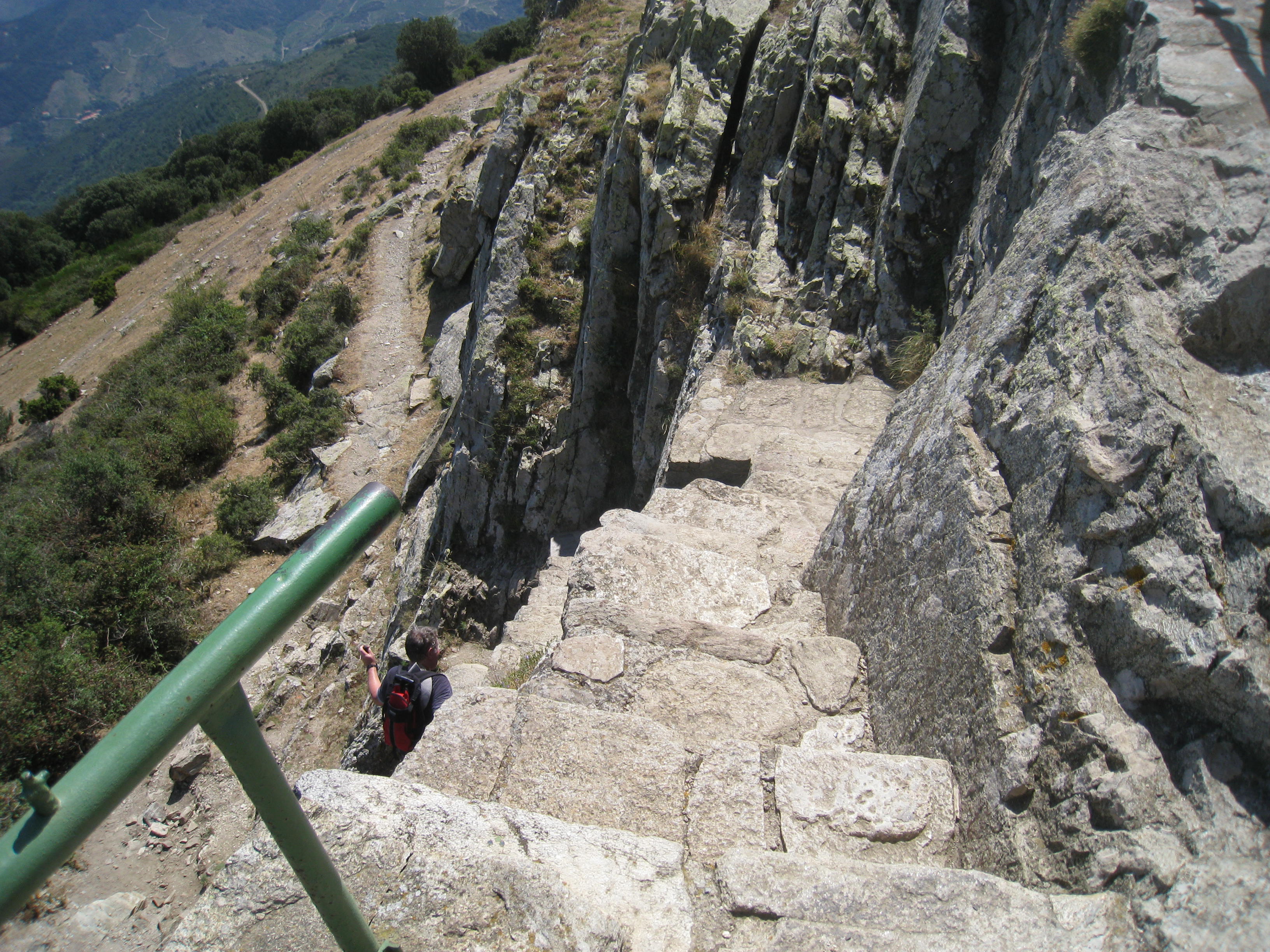
The Walk: Walk down to the road from which you entered car park and turn left. Drop down 200mtrs and take broad track on left signed to the Torra de la Macana just before river and Clos des Mimosas camp site. Skirt high walls of the Chateau to the start of the ascent on the left. The rocky path sets the tone for almost all the upward part of the walk.
Quickly gain height and look down on the Chateau. Emerge on a piste, go left then follow signed path off to right after short distance. About 30 mins into the walk arrive at a large cairn . A Dolmen is situated to the left if you wish to visit. Continue ahead on the marked path.
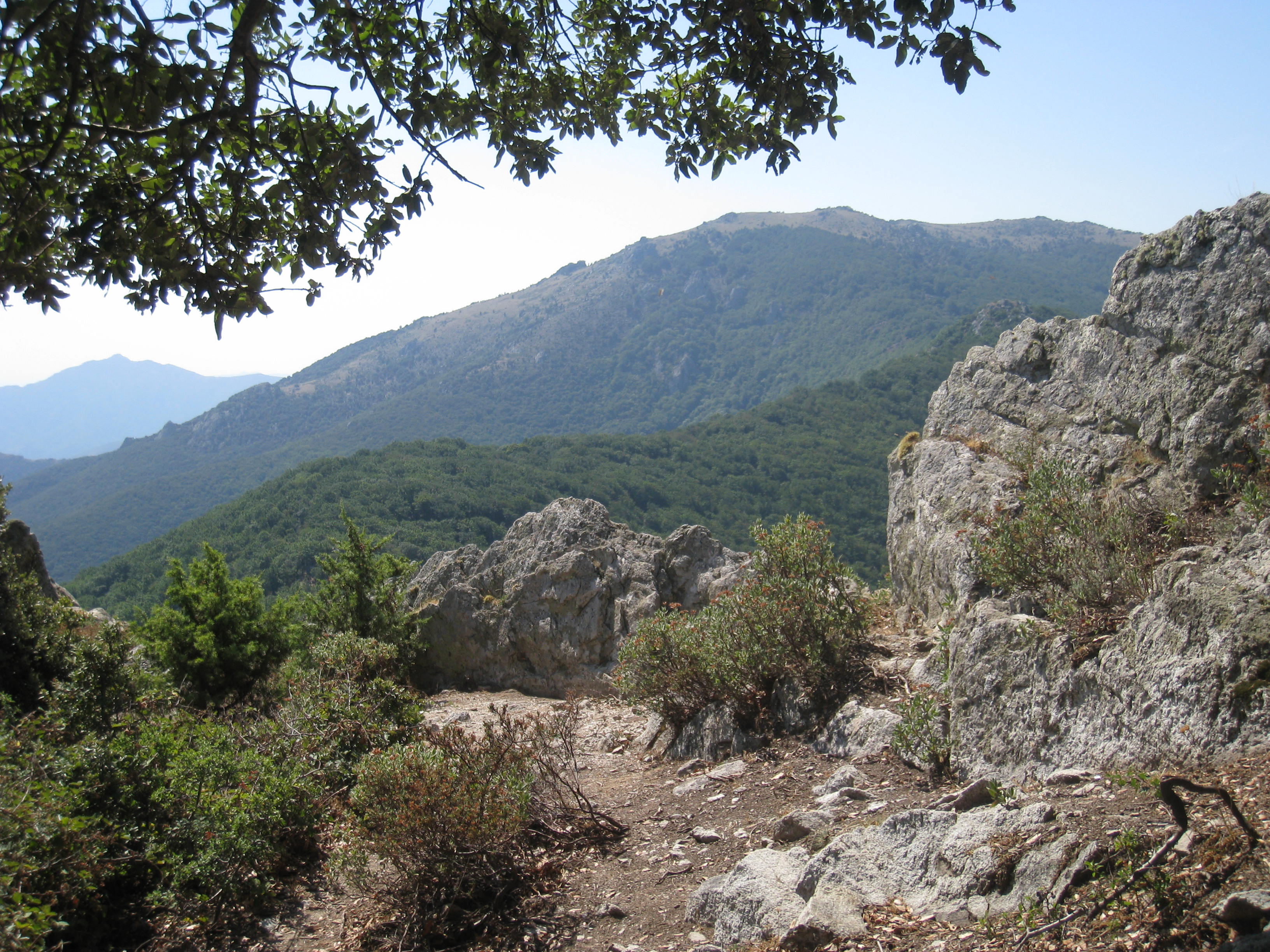
Cross another piste as you climb, and pass another Dolmen. After a time the path comes out on a more level plateau with super views over Argeles and the coast.
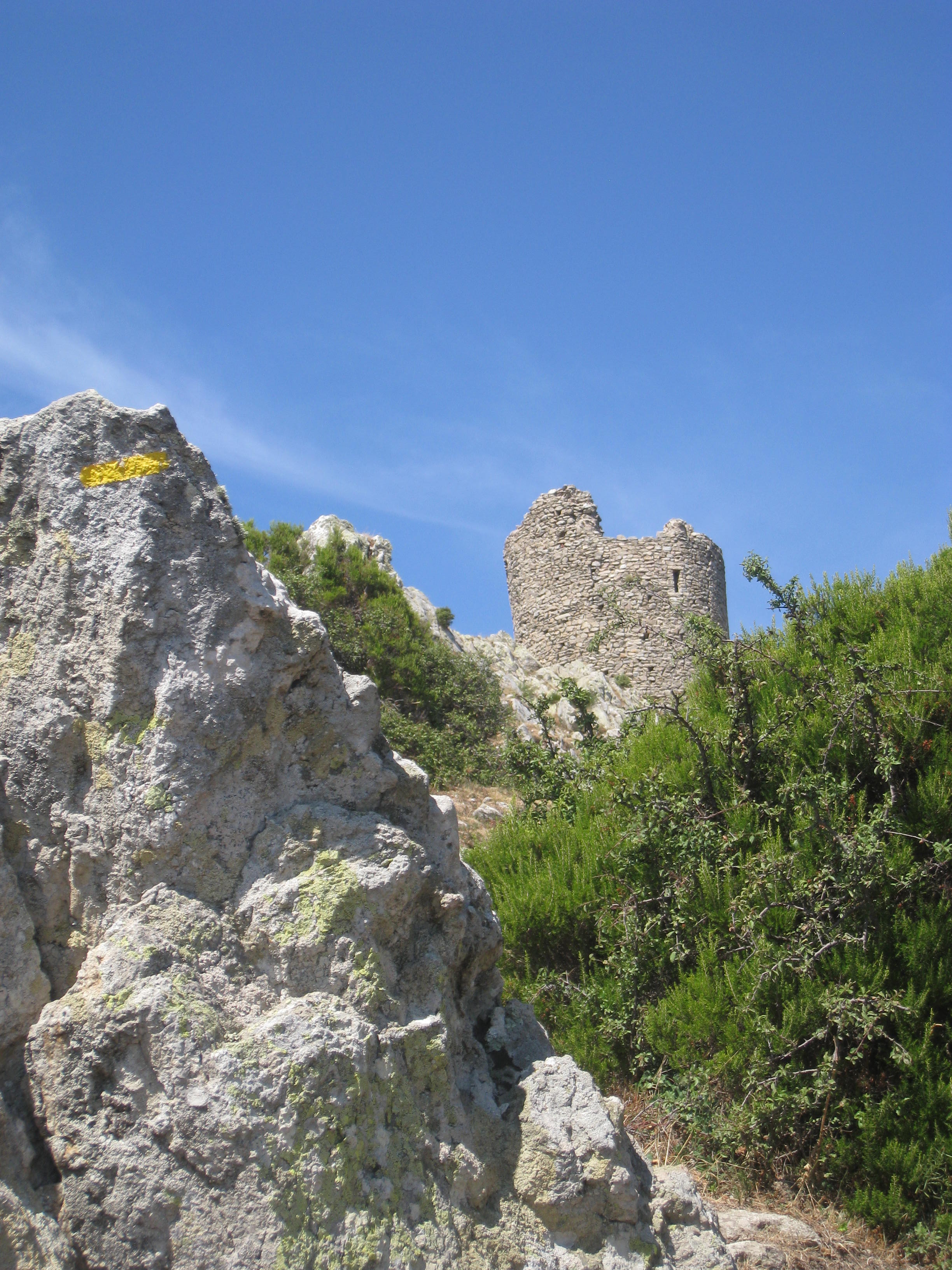
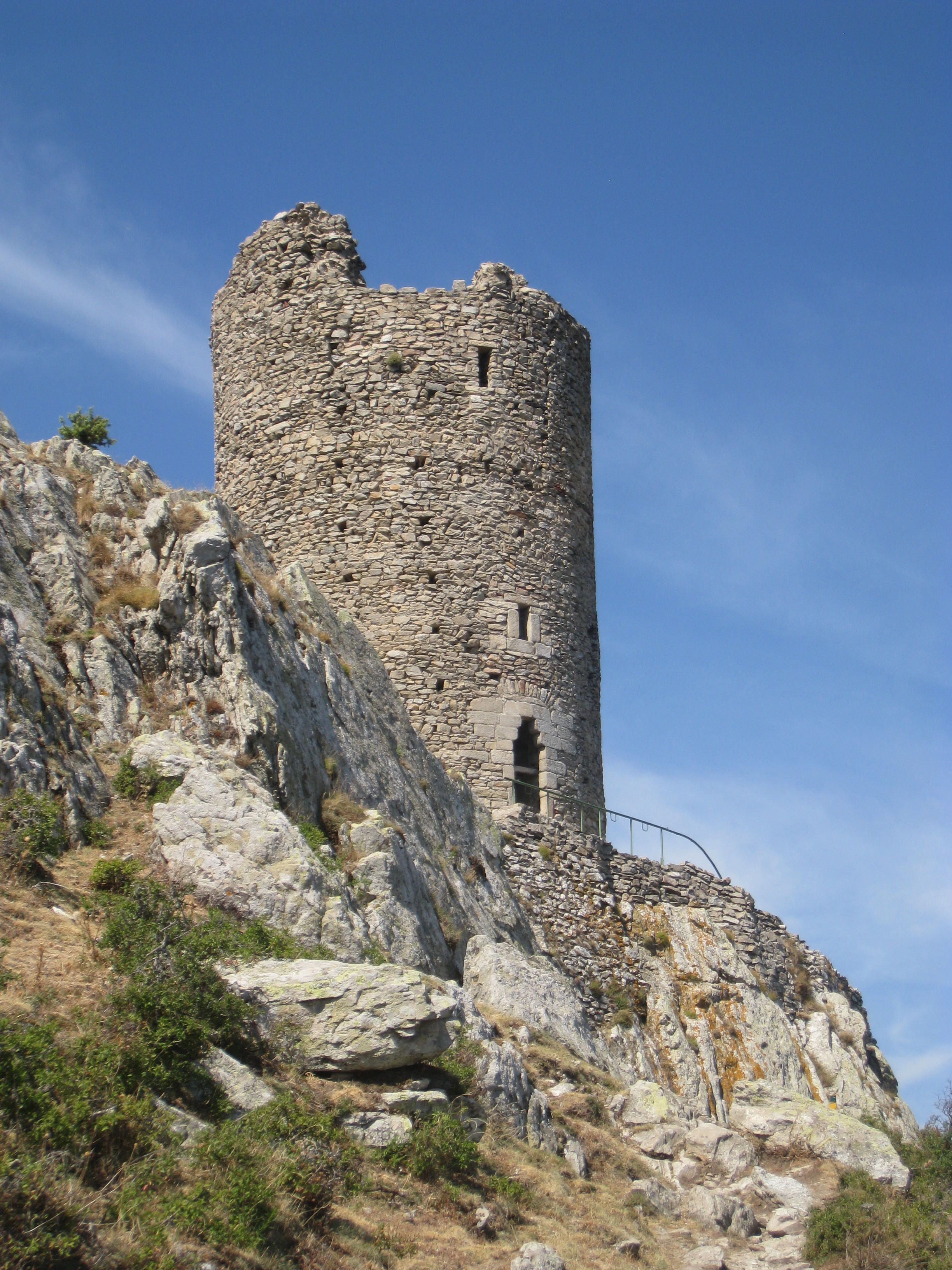
The Tour de Massane can now be seen clearly on the top of the peak to your right.
There is a waymark indicating a right turn but go straight on and drop down to a crossroads of pistes. Col d’en Selva 363mtrs (1h 15mins)
A left turn for 20 mtrs takes you to the foot of the next section of rocky path. In times of heavy rain this must be a canyoning excercise!. Cross another piste then continue to the next piste – turn left and walk up this piste about 350 mtrs to find the next section of the path. At Font Andreas keep climbing to the left through woodland with a soft soil path until you meet the path arriving from Salfort on your left. Turn right up the last steep rocky section of 250mtrs, to reach the summit. (2 ½ hours)
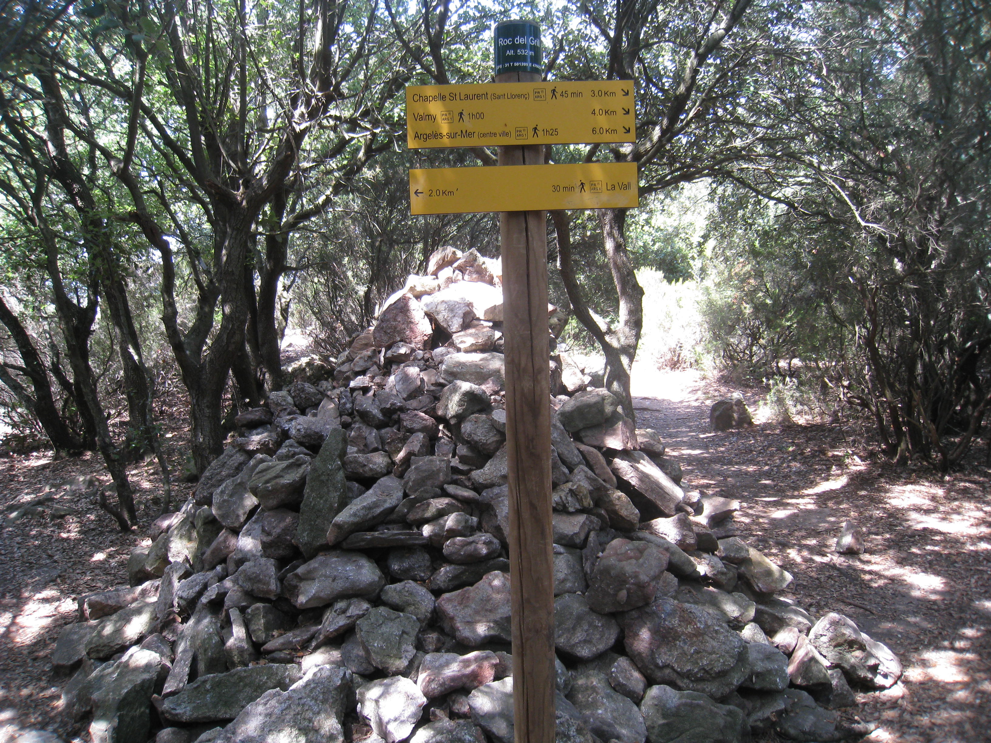
Explore the tower and take in the fantastic views then descend to the other side of the plateau to pick up the path to Lavall. Follow this along the hills, gradually descending, for at least 1 ½ km to reach a very large cairn – Roc del Grill
The route back down to Valmy is clearly signed to the right – 4km.
We had thought of visiting the Chapelle de St Laurent and missed a trick by not taking a right turn towards the end of the ridge, because when we emerged at a piste lower down it was 1km back to the Chapelle.
That will have to be for another day!
The path back to Valmy is a mixture of some piste and some footpath. The bar at Clos des Mimosas looked very inviting – it is open to walkers and both drinks and Tapas were on offer.
Refreshments may be available at the campsite near the end of the walk during the season.
Thank you for your lovely overview of walks in the region. Could it be an idea to also post a Google maps or similar route if you have please? My best always, Jon
So glad you enjoy the walks Jon and yes, a map would be an excellent edition, but we are such a tiny editorial team (moi!) that we just never seem to find the time! It’s on the list!! 🙂